Indians of the Americas
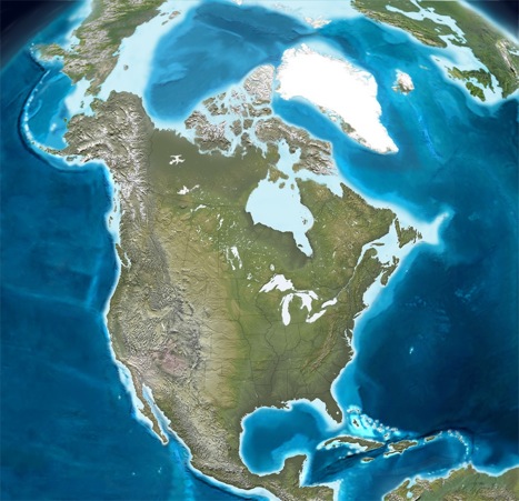
North America, Greenland and the Caribbean islands.
Maps:
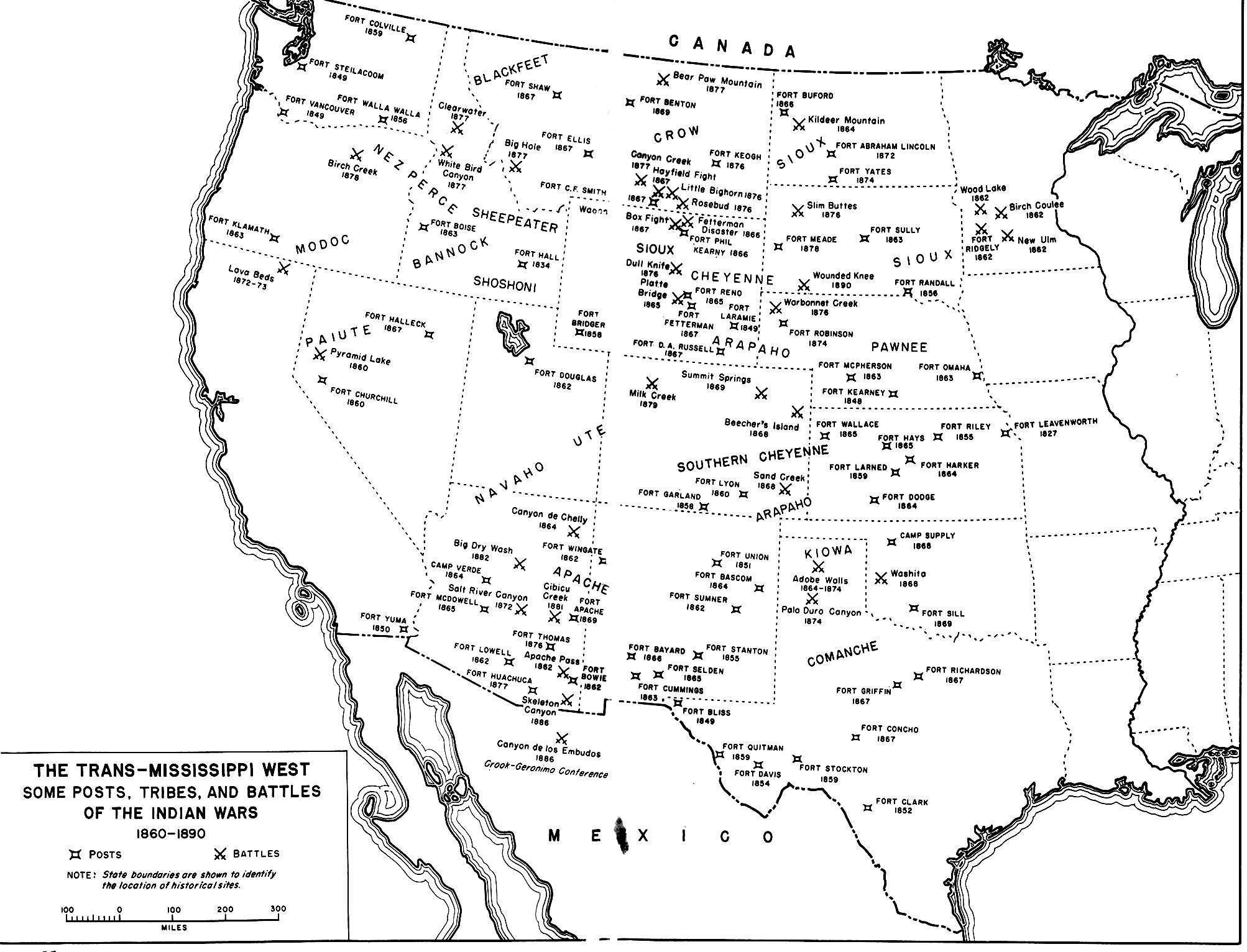
1620, 1797, 1800, Eastern woodland Nations, Western frontier
By 1797 after five major wars among The Netherlands, Spain, England, France, Sweden, and Denmark the boundaries of colonial possessions and independent entities were established on the eve of the Haitian revolt against Napoleonic France. The Native nations were legally subject to one or more of the European powers where substantial indigenous populations still remained.
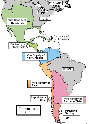
The Spanish provinces of the Americas, 1790s.
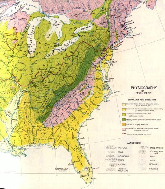
EASTERN Physiographic Provinces.
Maps:
1620, 1797, 1800, Eastern woodland Nations, Western frontier
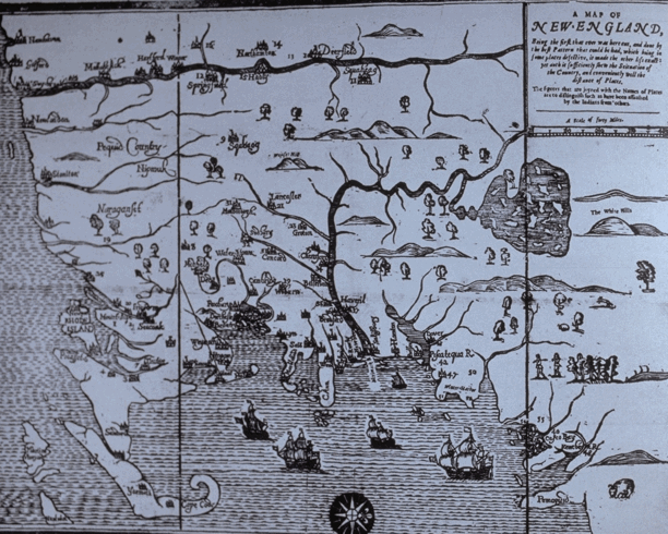
In the 1620s the earliest French maps encouraged English and Dutch competition to create stable settlements in the areas north of Virginia in order to assure supplies of fish, furs and gold. While the gold was elusive the Native nations traded furs and crops for European iron and glassware. In addition the timber needed for ships and barrel making was of perpetual value to the settlements.
Maps:
1620, 1797, 1800, Eastern woodland Nations, Western frontier
Native or Indian peoples, First Nations.
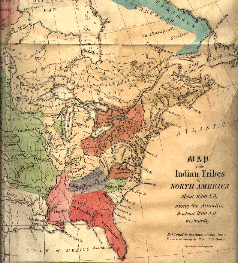
Albert Gallatin commissioned this map as Treasurer of the United States in order to establish the Indigenous Nations from whom the land obtained by the new federal government had been or would soon to be acquired for sale to U.S. citizens.
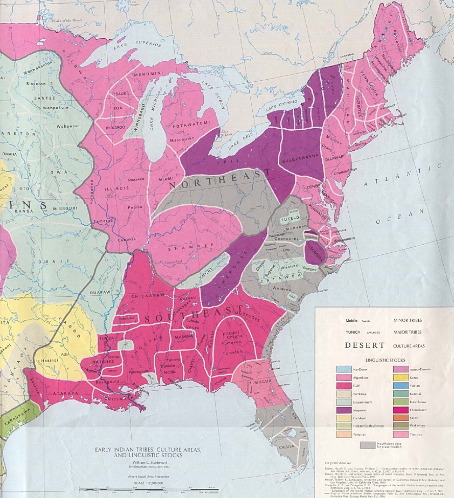
Native American Nations and associations east of the 100th meridian at the arrival of European settlement, who were largely settled agricultural peoples raising corn, beans, squash and wild turkeys they may have numbered over five million before the epidemics struck preceding the arrival of European exploration and missionary activity.
Maps:
1620, 1797, 1800, Eastern woodland Nations, Western frontier
WESTERN Physiographic Provinces.
The irony of Native Nations' more enduring settlement patterns is indicated by the ruins of abandoned cities in the Southwest called pueblos by the Spanish. This irony lies in the fact that the largest construction projects of both ritual and residential buildings appeared in the arid Southwest, not the humid and rainfall enriched Eastern regions. Irrigation canals and recognizable field patterns based on corn, beans, and squash cultivation are found from these desert southwest cities into more wooded regions of Canada and New England, across the more diverse south and deep into the tropical highlands and lowlands of the Caribbean shores.
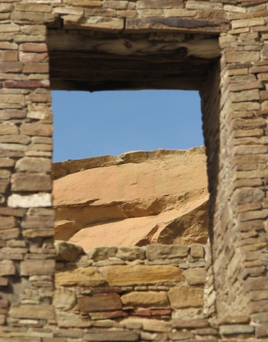 Window of a building in Chaco canyon, New Mexico.
Maps:
1620, 1797, 1800, Eastern woodland Nations, Western frontier
Art depicting early peoples and landscapes