![]()
Nature, Place, & Peoples of the Antillean Bioregion
![]()
Ecology of Europe in the Caribbean
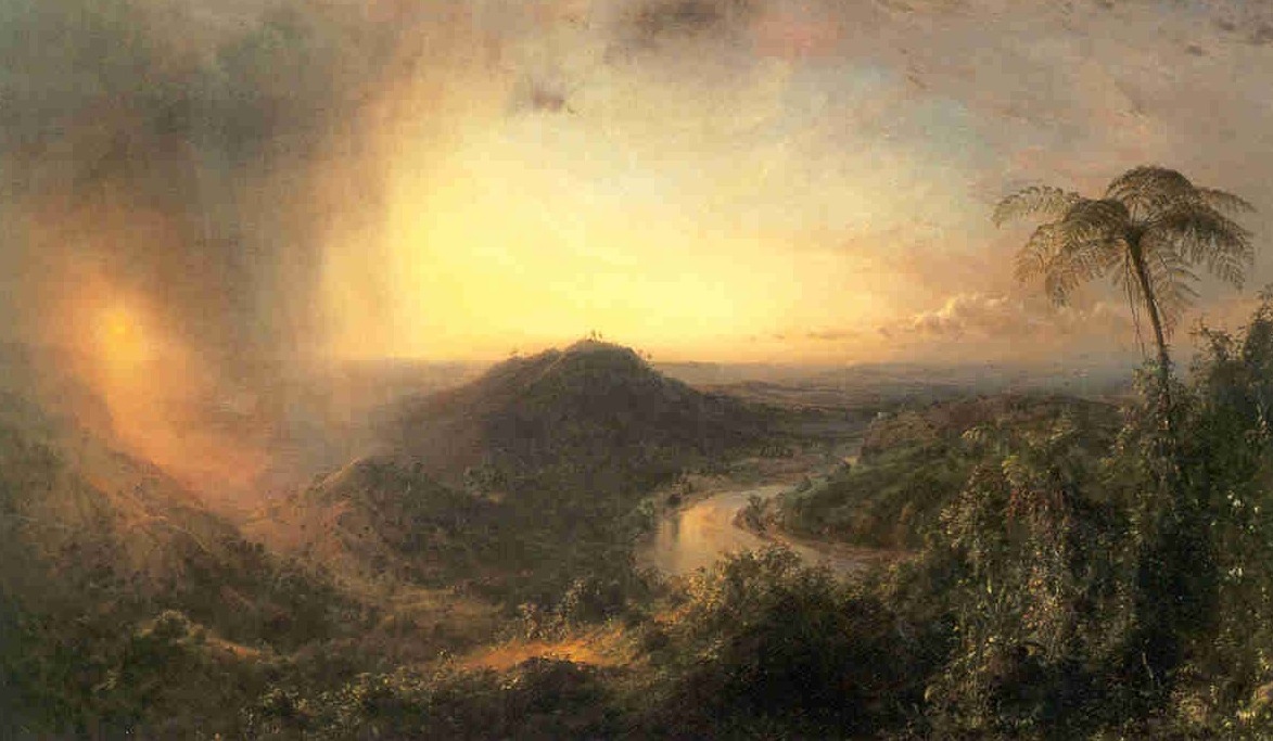
Frederic Edwin Church, The Vale of St. Thomas, 1867; Oil on Canvas. 1
![]()
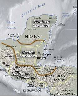
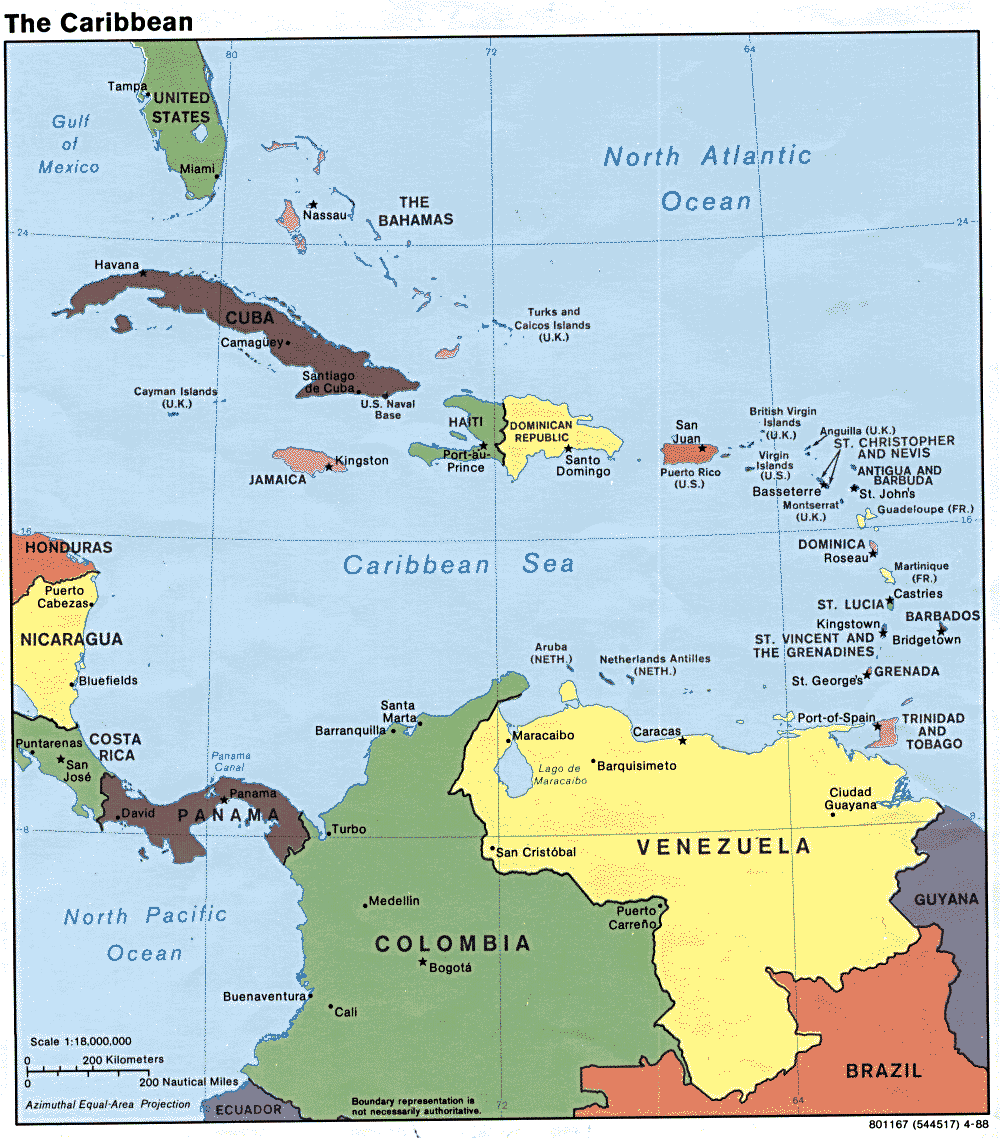
Tectonic, Geological, Historical and Cultural maps of Mexico, the Caribbean, the West Indies, the Antilles, and South America.
Geology | Plate Tectonics | Bathymetry | Volcanoes | Subduction? | Origin of words | History | Native Places | Islands | Current Forest cover | S. America
![]()
![]()
| Where are today's nations? |  |
|
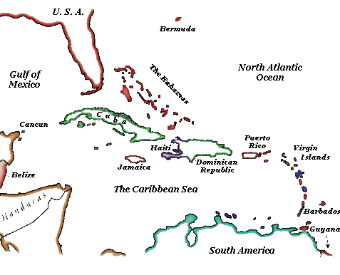
| The many Nations of the Caribbean basin. | 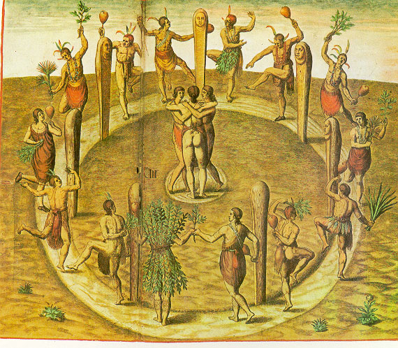 |
|
 |
||
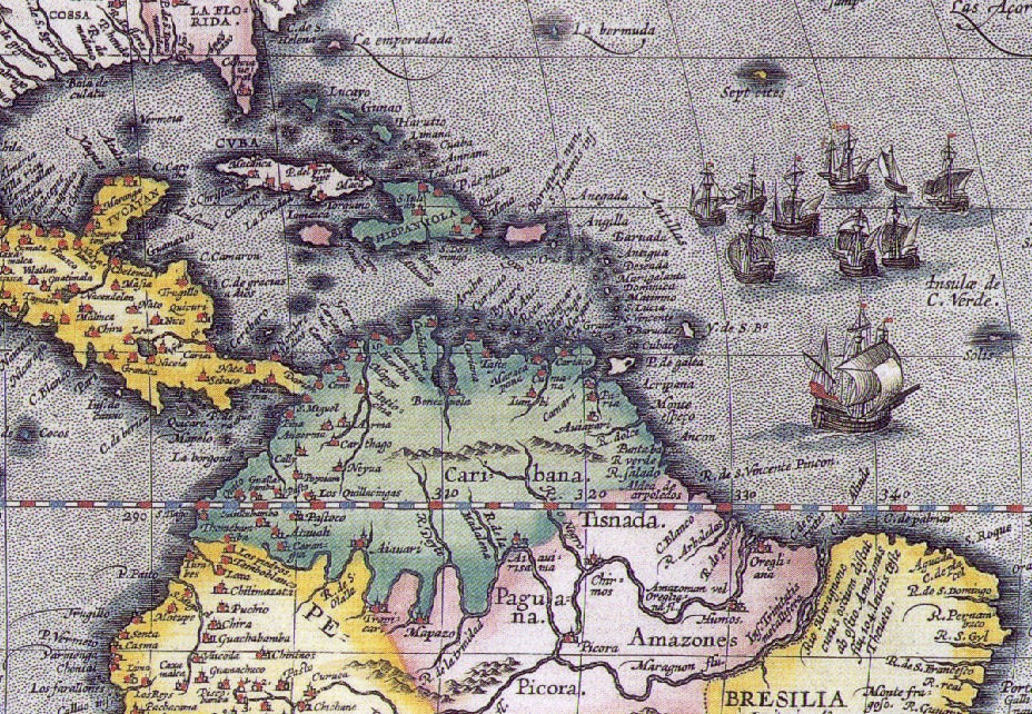
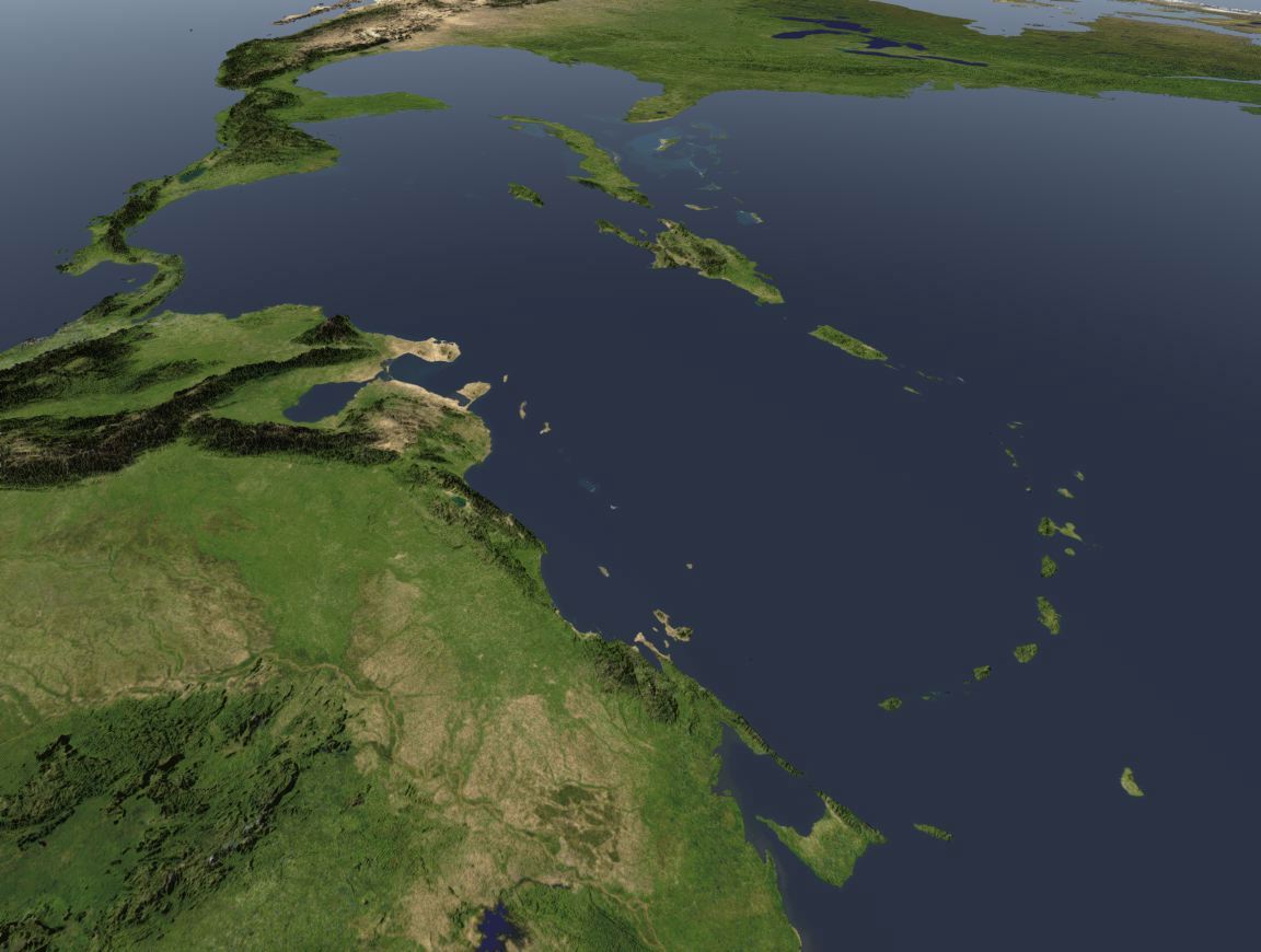
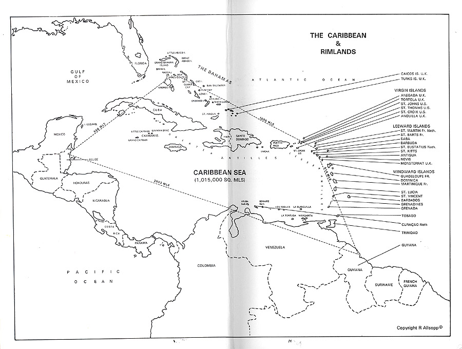
| Antilles, | the larger regional map showing the Yucatan, Central and South America, greater and lesser Antilles islands of the West Indies in the Caribbean Sea. | |
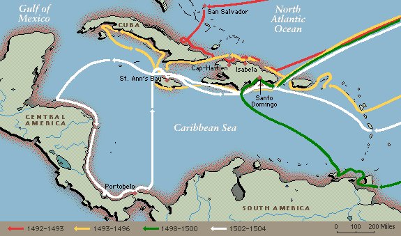
Columbus convinced the Spanish crown to fund four voyages to what he thought was Asia and the East Indies.
![]()
The Setting
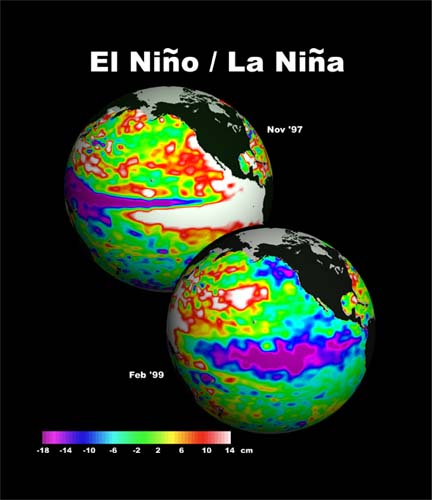
Native agriculture was dependent on El Nino (wet), La Nina (dry) patterns.
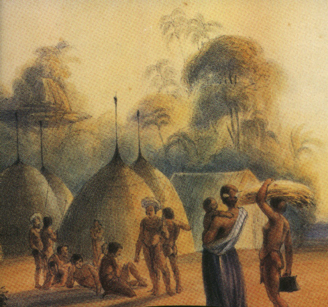
Maya: Yucatan lowlands and Southern Mexican Plateaus, were centers of chocolate production and minerals such as jade, silver and gold.These areas were proximate to the vast inland seas that generated trade with the Arawak; oldest literate peoples, and the older Ciboney and Taino inhabitants who like the Mayans had been through 2 cycles of growth & decline in their peopling of these many and varied islands that lay north of the "Caribana and Amazones" coasts as shown in the map below – note the numerous Spanish missions [red/amber dots].
From its position situated among the Peruvian highlands to the south and Aztecs of central Valley of Mexico, and trade with Mayans and Hopi pueblos of SW, the Antilles were a natural bridge among native peoples.This integral role remained even well after Tenochtitlan, fell 1519, and smallpox epidemics reduced the islander populations by 1590.
As the European imperial rivalry began to chip away at the Spanish possessions after 1600, the Caribbean remained a contentious sea of disputes until the end of the Atlantic slave trade in the early 1800s.
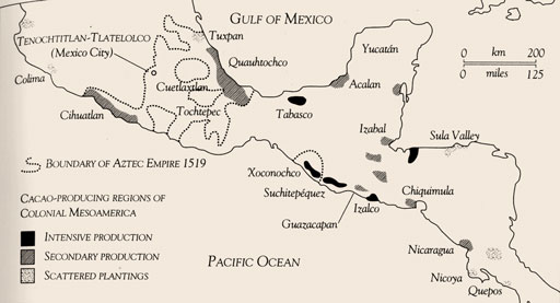
The locations of cacao growing.
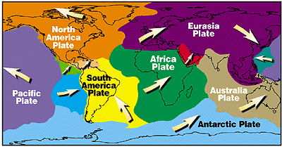
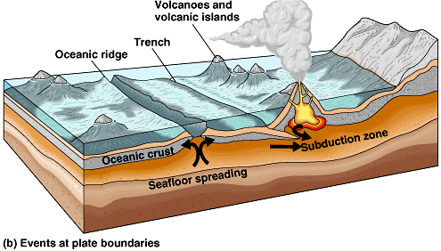
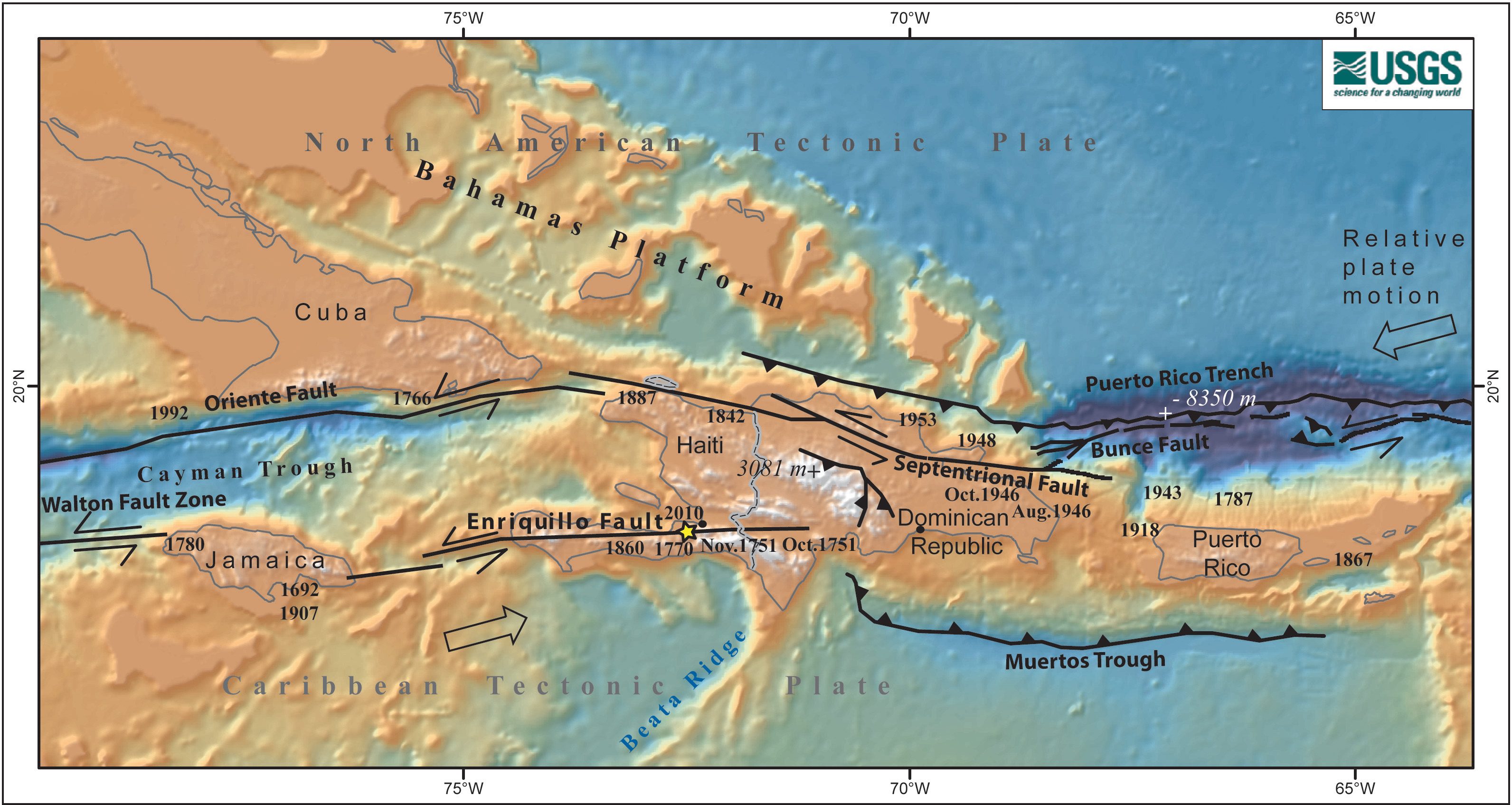
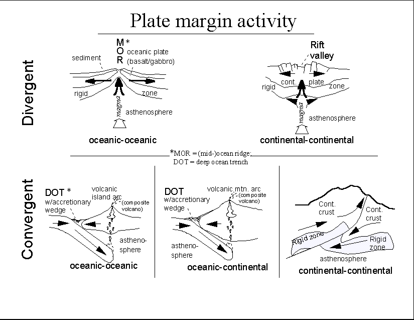
The geology of this region cannot be understood apart from plate tectonics.
Why does the Caribbean look as it does, geologically speaking?
Geological forces at work in the Antillean Bioregion.
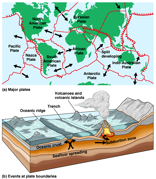
The larger Earth's plate portrait; of which the Caribbean is but a piece:
Plate Tectonics is the study of the geological drift and consequent reshaping of the crustal surface of the planet.
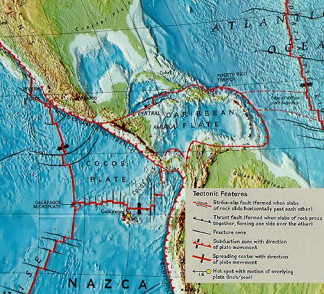
Regional Plate Boundaries
Geology | Plate Tectonics | Bathymetry | Volcanoes | Subduction? | Native Places | Islands | Current Forest cover | summary | S. America
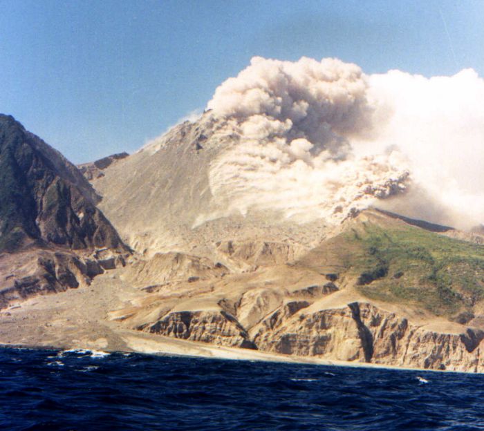
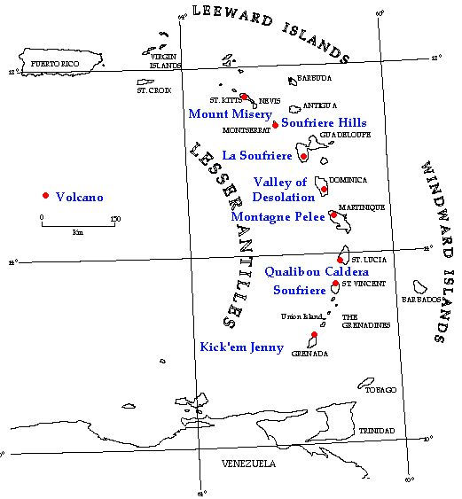
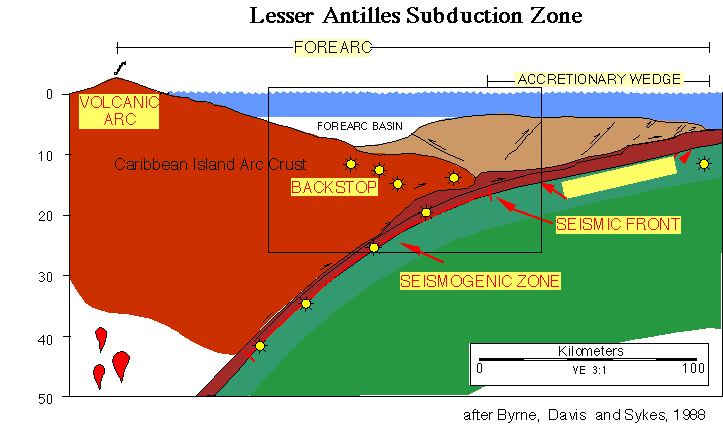
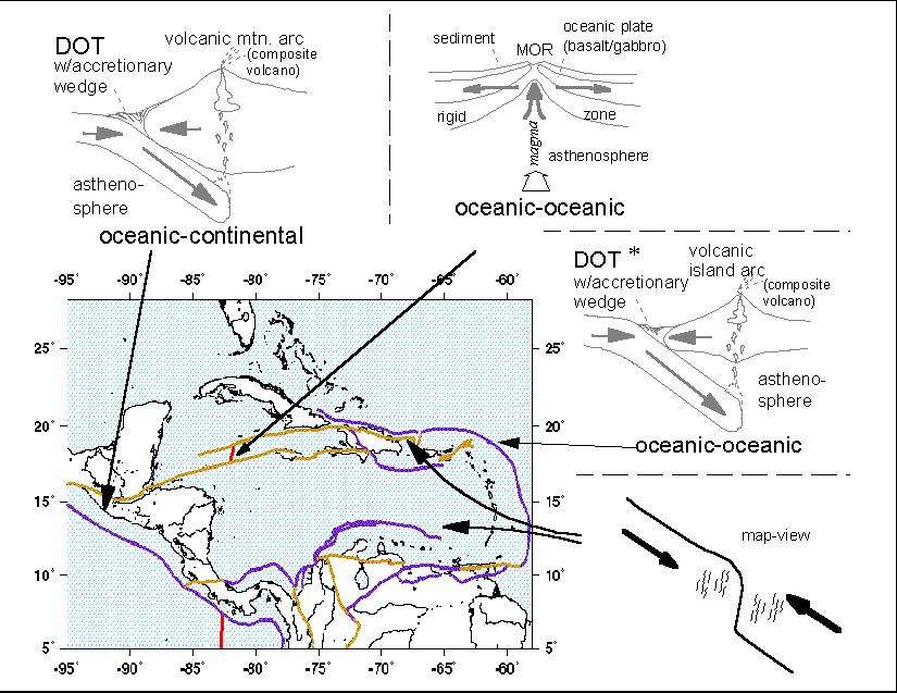
Volcanoes occur at plate boundaries called subduction zones.
A volcano island of Montserrat exploded in 1995 and again in 1997 leading to abandonment of half the island.
Geology | Plate Tectonics | Bathymetry | Volcanoes | Subduction? | Native Places | Islands | Current Forest cover | summary | S. America
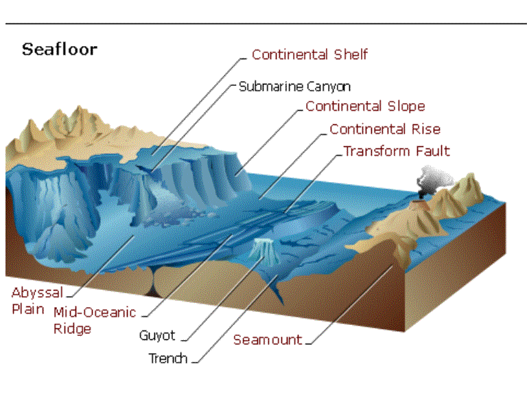
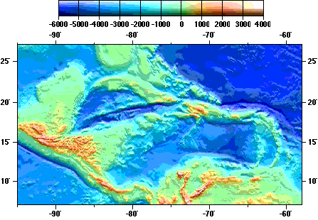
Bathymetry (ocean floor configurations) and locations of shallow and deep water.
Three plates collide in the Caribbean & Mexico Volcano Island Arcs are an indicator of a plate boundary
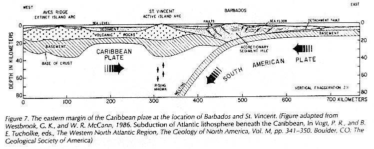
The Caribbean plate is deflected under the North & South American Plates
Geology | Plate Tectonics | Bathymetry | Volcanoes | Subduction? | Native Places | Islands | Current Forest cover | summary | S. America
Narrow land bridge
Three million years ago these tectonic forces forced up a mountain block called the Darien Gap where the Panamanian Isthmus separated the Caribbean from the Pacific Ocean.
These Guatemalan mountains are part of the orogeny that closed circum-equatorial oceans and created the isthmus of Panama.
Types of geological pressures:
Geology | Plate Tectonics | Bathymetry | Volcanoes | Subduction? | Native Places | Islands | Current Forest cover | summary | S. America

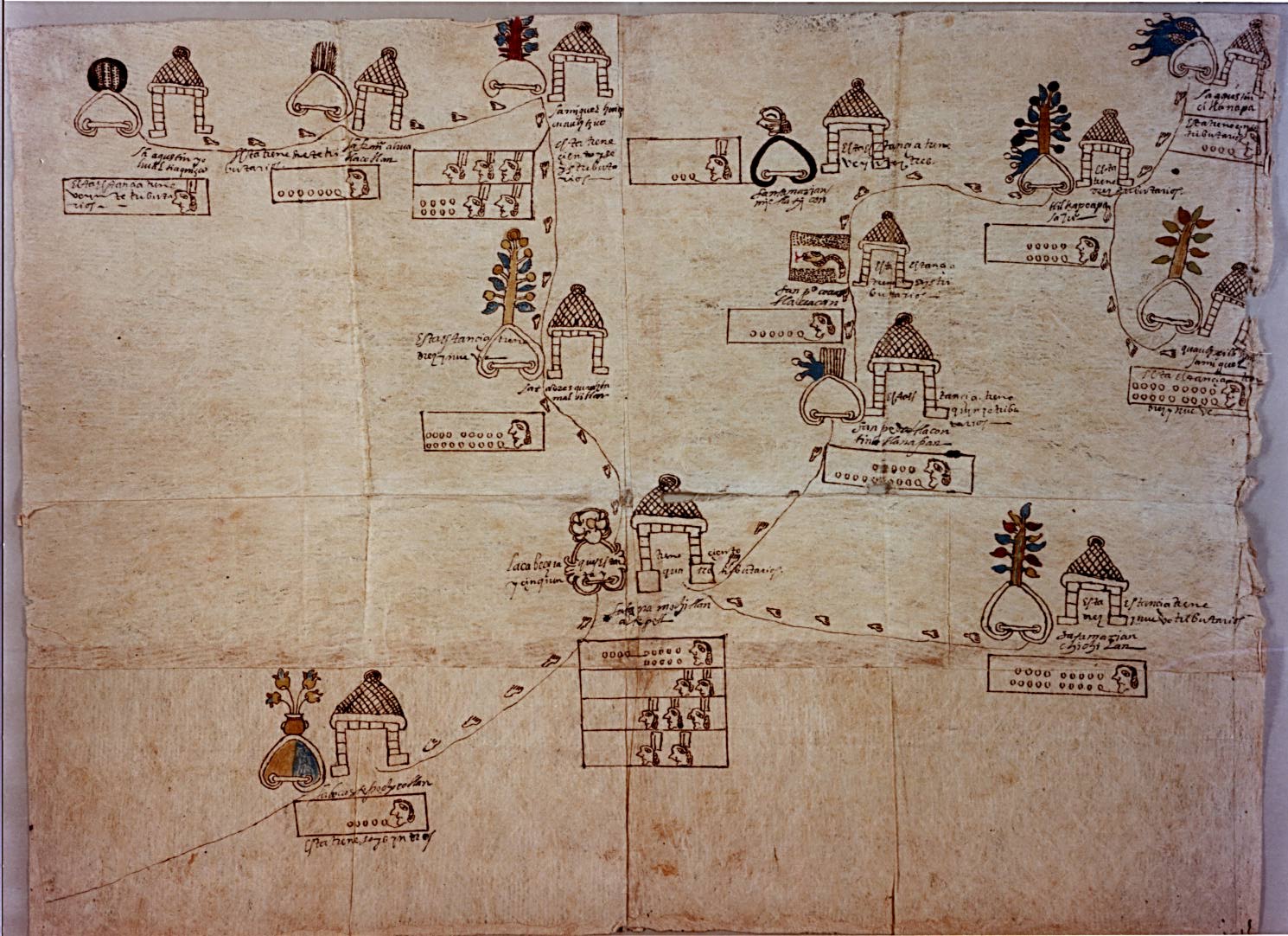
History of dominant Precolumbian cultures adjacent to the West Indies and the Caribbean Sea.
Mexico | Cuba | Jamaica | Hispaniola
Three centuries or more of images from Mexico and the Andes, reveal the antiquity of these civilizations.
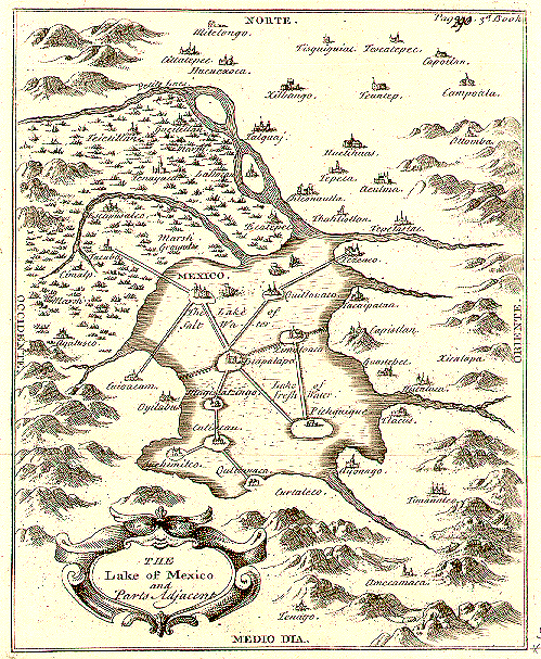
Spanish Map of the Aztec and Mayan regions
Zumpango, Spanish and Nahuatl language map of Meso America c 1570.
Geology | Plate Tectonics | Bathymetry | Volcanoes | Subduction? | Native Places | Islands | Current Forest cover | summary | S. America
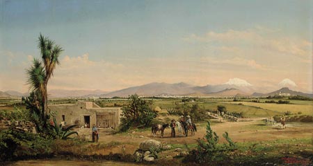
Mexico
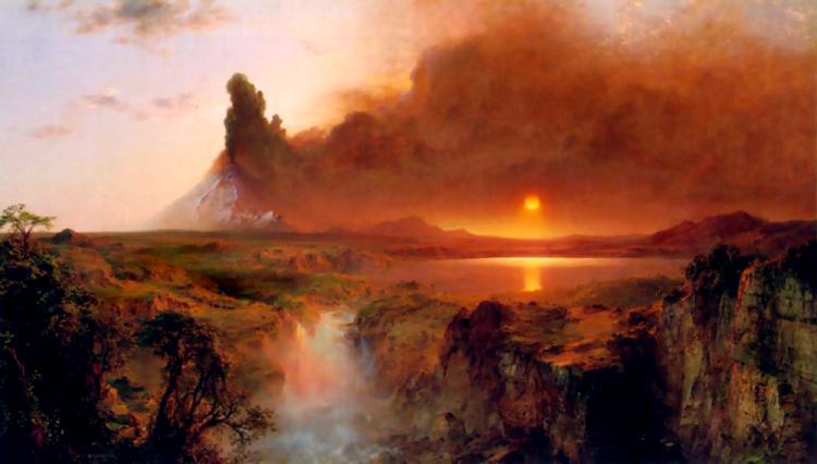
Cotopaxi volcano painted by Frederic Church in the 1862.
Aztec Mexico 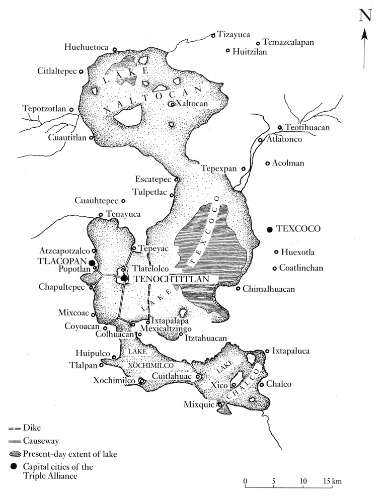
1550
A Spanish map of Mexico in 1550.
![]()
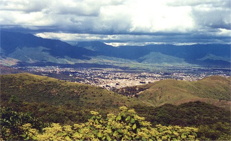
South America, 16th Century:
Peru as the Spanish focus in settling Latin America, where and Quechua speaking peoples still dominate the mountain populations of Peru and Bolivia respectively. (c. 1585)
Geology | Plate Tectonics | Bathymetry | Volcanoes | Subduction? | Native Places | Islands | Current Forest cover | summary | S. America
Hispaniola
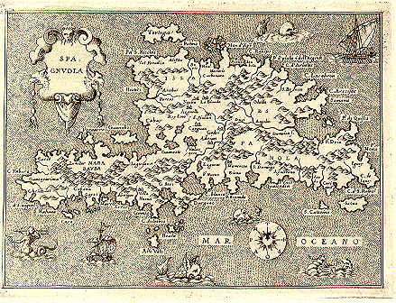
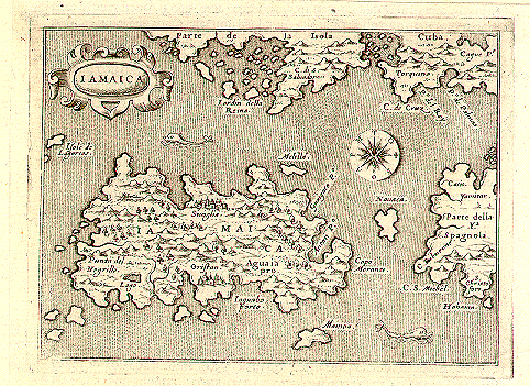
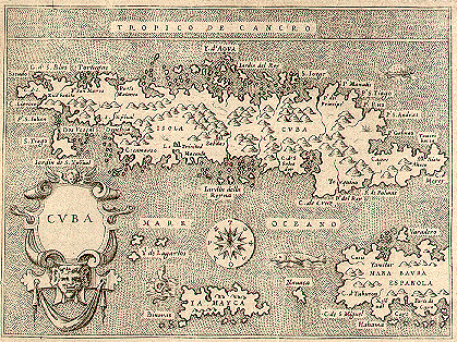
1576 map series from the Yale University Archival Map room.
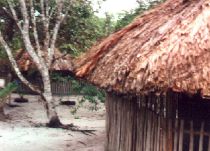
Jamaica
Cuba
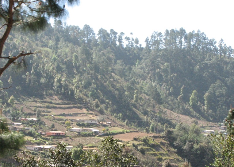
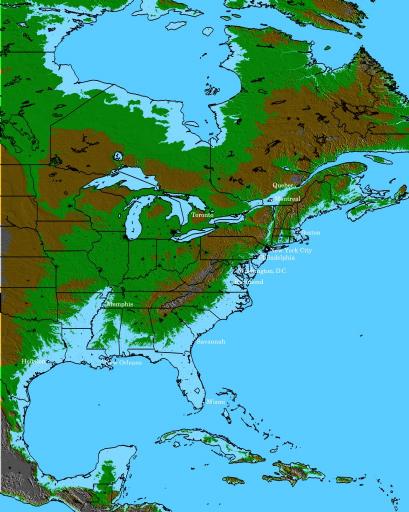
Forest cover remaining in the Antilles.
The Vale of St. Thomas, Jamaica, 1967. Oil on canvas, 48-1/2 x 84-5/8 inches
Frederic Edwin Church (1826–1900), Wadsworth Atheneum Museum of Art; bequest of Elizabeth Hart Jarvis Colt. 1905.21"
While in Jamaica from 1864-65, "Frederic Church and Harold W. Robbins also visited the famous Bog Walk and climbed Monte Diabolo, “a wild and pretty high mountain” that afforded them “the sweetest & finest views” overlooking “the Parish of ‘St Thomas in the Vale’ . . .”5 This prospect “so beautiful and grand” became the inspiration for Church’s grandest Jamaican canvas, The Vale of St. Thomas, Jamaica, 1867 (Fig. 3). The scene looks south over the valley of the Black River with a distinctive tree fern anchoring the foreground. As a token and a testament to the tropical plants he recorded, Church sent a tree fern to his patron, Elizabeth Hart Colt, who had commissioned the painting."
A discussion of sources for the origins of the word: "Antilles".
From Random House, the following discussion has been excised:
"The reliable Encyclopedia Britannica says:
"The term Antilles dates traditionally from before Europeans discovered the New World, when 'Antilia' referred to semi mythical lands located somewhere west of Europe across the Atlantic. On medieval charts it was sometimes indicated as a continent or large island and sometimes as an archipelago. After discovery of the West Indies by Columbus, the Spanish term 'Antillas' was commonly assigned to the new lands, and 'Sea of the Antilles' in various European languages is used as an alternate designation for the Caribbean Sea."
Donald Johnson's 1994 book, Phantom Islands of the Atlantic: The Legends of Seven Lands That Never Were, devotes an entire chapter to "Antillia," as he spells it. Johnson says that the first map to ever show the word Antilia was made in 1424. I found this map in an exhibit at The University of Minnesota's excellent John Ford Bell Library website called Portolan Charts. Portolan charts, created before Columbus's discovery of America, were navigational charts that contained the accumulated knowledge of sailors and navigators. ("Portolan" basically means 'getting to a safe port, haven'.) These charts were made in the 13th, 14th and 15th century, and some are quite accurate. On the 1424 chart, which was made by a Venetian cartographer named Zuane Pizzigano, you can actually see the word "antilia" next to a big, rectangular island. "Throughout the fifteenth and early sixteenth centuries," Johnson writes, "Antillia's position on maps is consistent." That position is always around seven hundred miles west of the Azores. The inference is that different sailors from different countries came upon Antilia, and so it actually existed.
Columbus apparently knew of Antilia. "Cartographers as well as historians," Johnson continues, "felt that the Antillia on old maps represented a foreknowledge of the New World. After the discoveries of Columbus, they accordingly transferred Antillia to a new position in the West Indies." Of course, no theory like this would be complete without rival interpretations. In a 1988 paper about the subject, scholar Robert Fuson declared Antilia to be Taiwan.
But what of the origin of the word "Antilia?"
The Bell Library exhibit cites a 1954 study by Armando Cortes` on the 1424 chart. Here's what Cortes` has to say:
The origin and meaning of the word Antilia have been a subject of much controversy. In fact Antilia is composed of two Portuguese words: "ante" or "anti" and "ilha," an archaic form of the Portuguese "ilha," i.e. 'island'. It is, therefore, a purely Portuguese word and it was meant to designate an island--discovered perhaps at the beginning of the fifteenth century by some unknown navigators, probably Portuguese--lying before a continent, which at first might have been thought to be Asia, or opposite the European continent.
To view, look for the red island on the the map, go to: http://www.bell.lib.umn.edu/map/PORTO/1424/west.html
©1999-2001 by the Regents of the University of Minnesota, Twin Cities. University Libraries. All rights reserved.
Please credit the: James Ford Bell Library, University of Minnesota if you copy or reproduce material from this page.
URL: http://www.bell.lib.umn.edu/index.html
For the etymology see: http://www.randomhouse.com/wotd/index.pperl?date=20010125
Geology | Plate Tectonics | Bathymetry | Volcanoes | Subduction? | Origin of the word | Native Places | Islands | Current Forest cover | summary | S. America
![]()

![]()