California: the Images and the Ideals
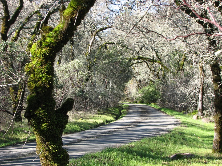 Winter's morning on a Sonoma County roadway.
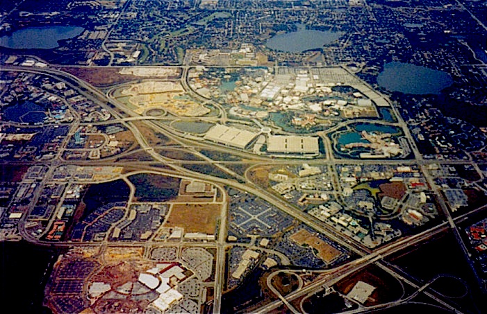
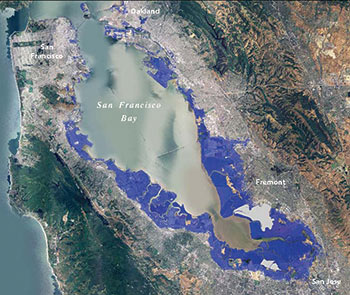
Two sides of California's waters: natural and cultural advantages bring with them consequences.
Winter's morning on a Sonoma County roadway.
Two sides of California's waters: natural and cultural advantages bring with them consequences.
Overview
| Introduction | Maps | Photo Essay
of the landscape | The Great Thirst | Water
Seekers | Two Cities | Southern
Charms
  |
 |
| State of mind |
State of California |
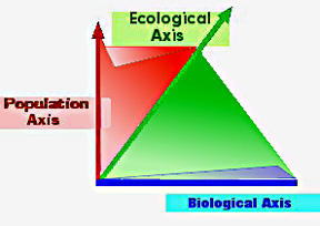
Every landscape, water-scape and seascape is literally comprised of three
dimensions [x, y & z] and by analogy so these places are –by the interplay of biology, population and ecology– endowed with life. California is best understood through its biological wealth of creatures, its 39,309,017 population [2016] and the ecological composition of its soils, climate, bacteria, fungi, vegetation, and animals.
Energy Market Reforms
The Long view
"Give me men to match my mountains"
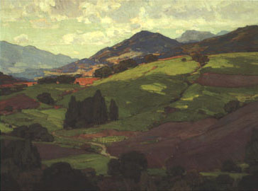
Edgar Payne's paintings of California are impressions of a lost landscape from the early 1900s.
Sierra
Foothills, places where the greensward covered the hidden gold.
Edgar Payne's impressionistic paintings of California are rare glimpses of lost landscapes from the early 1900s.
The California Coastal Ranges, where nature puckers along the San Andreas
Fault, lifting mountains five to ten thousand feet into the Pacific Ocean winds.
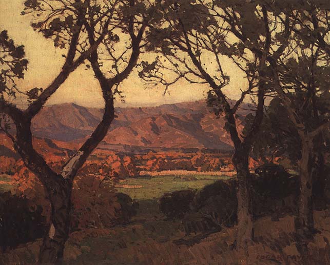
 Another of Edgar Payne's impressionistic paintings of Santa Barbara, California
Ceonothus blooms in the spring near Santa
Barbara bathing the painting in blue.
Another of Edgar Payne's impressionistic paintings of Santa Barbara, California
Ceonothus blooms in the spring near Santa
Barbara bathing the painting in blue.
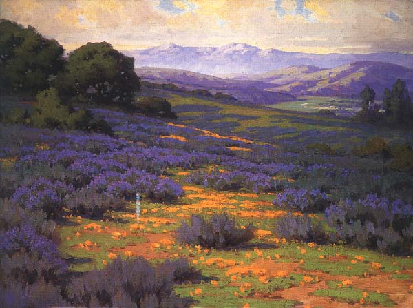
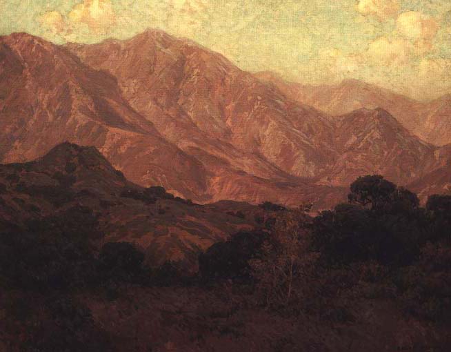 Edgar Payne's impressionistic painting interpreting the immensity Sierra Nevada's foothills and mountains.
Sierra Nevada Mountains, called by John Muir the "range of light" in 1894 are a series of high peaks forming a natural granite wall seventy miles wide and nearly four hundred miles long sealing off the state from the
rest of North America –to the east– for the last 50 million years when the gradual mountain-building (orogeny) began.
Edgar Payne's impressionistic painting interpreting the immensity Sierra Nevada's foothills and mountains.
Sierra Nevada Mountains, called by John Muir the "range of light" in 1894 are a series of high peaks forming a natural granite wall seventy miles wide and nearly four hundred miles long sealing off the state from the
rest of North America –to the east– for the last 50 million years when the gradual mountain-building (orogeny) began.
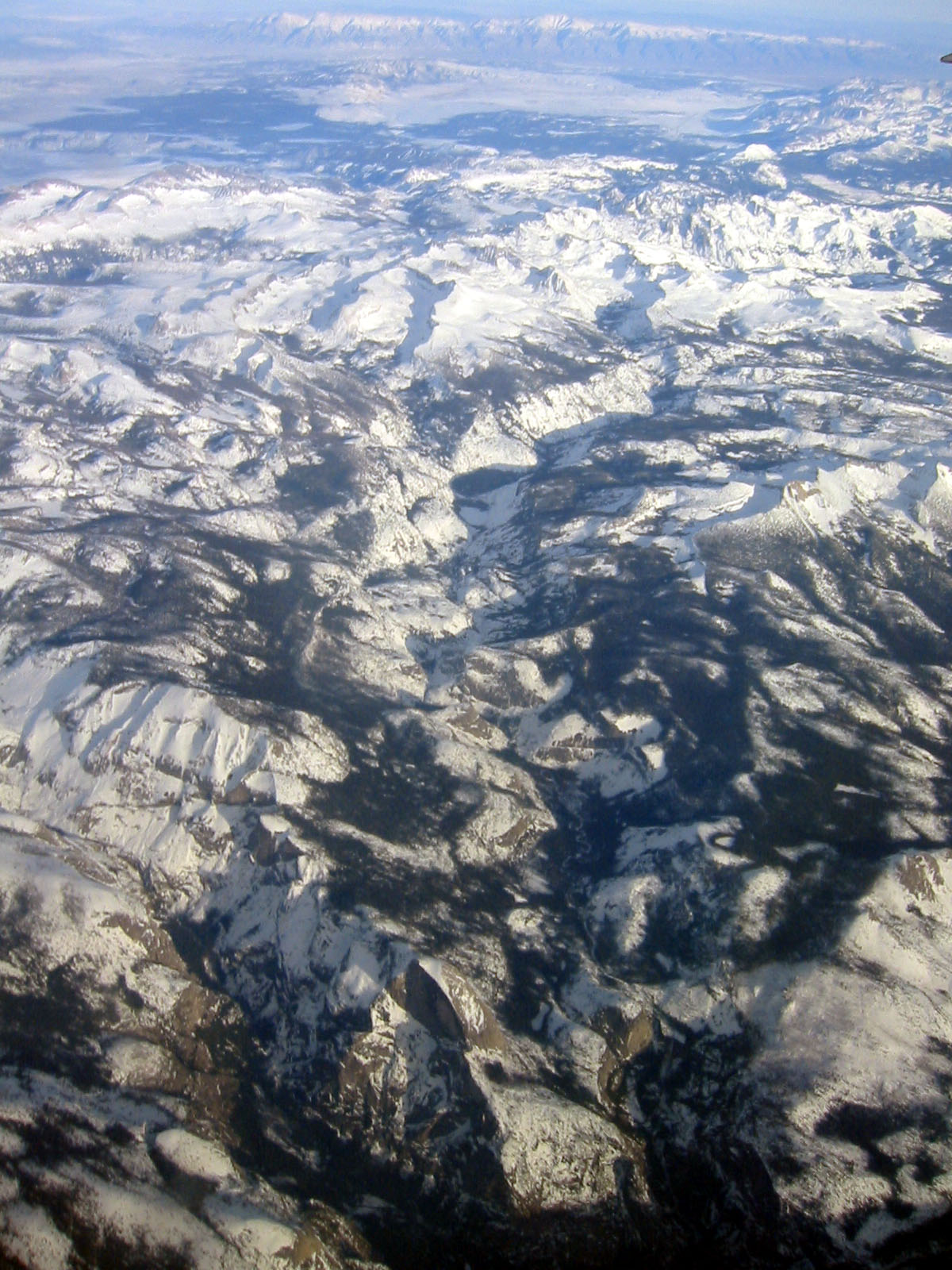 The original Spanish meaning of Sierra (mountain) Nevada is "snowy mountain range." In the lower center of the photograph is Yosemite Valley's iconic precipice, the glacially carved "Half Dome."
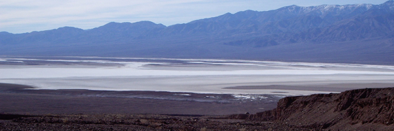
A salt pan in Death Valley.
The
eastern California deserts are littered with places called dry wells, 29 palms,
Trona, Devil's Postpile, and Lone Pine all cascading ultimately into Death Valley
south of Ubehebe Crater.
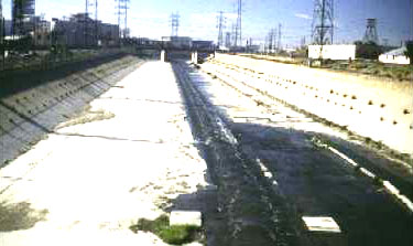
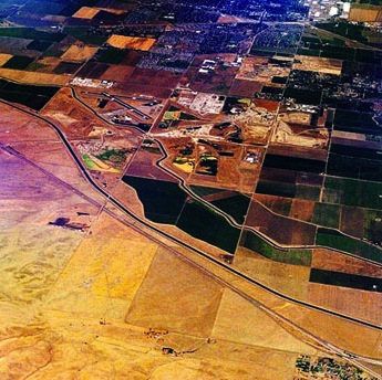 Aqueducts like the one pictured above, bring mountain waters to the
arid agricultural valleys and sprawling urban areas.
Aqueducts like the one pictured above, bring mountain waters to the
arid agricultural valleys and sprawling urban areas.
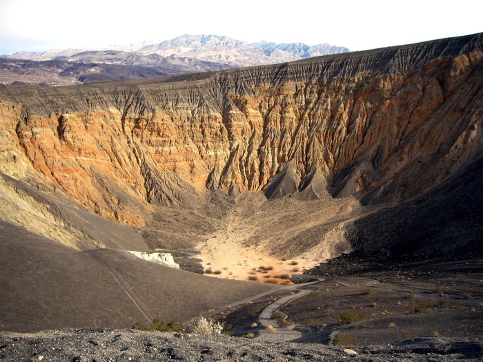
Ubehebe Crater in Death Valley on Racetrack Road.
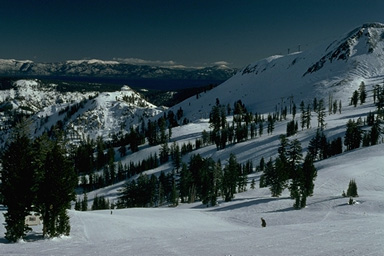
 Elna
Bakker, in her classic work: An Island Called California, refers to the
dominant cultural landscape as the Oak Savannah woodland, seen here in the San
Francisco Bay Area on the slopes of Mount Diablo.
She describes the state's "seven . . . major natural communities" of flora and fauna as distinct aggregations of plants because
of evolution, climate, isolation and recurrent patterns of drought, fire, freezes, and drenching
winter rains.
Bakker wrote: "This crazy-quilt arrangement is characteristic of many California hillsides, not only sea-facing flanks. . . . In many places man has seriously disrupted this natural patterning. . . ."
Elna
Bakker, in her classic work: An Island Called California, refers to the
dominant cultural landscape as the Oak Savannah woodland, seen here in the San
Francisco Bay Area on the slopes of Mount Diablo.
She describes the state's "seven . . . major natural communities" of flora and fauna as distinct aggregations of plants because
of evolution, climate, isolation and recurrent patterns of drought, fire, freezes, and drenching
winter rains.
Bakker wrote: "This crazy-quilt arrangement is characteristic of many California hillsides, not only sea-facing flanks. . . . In many places man has seriously disrupted this natural patterning. . . ."
- Coastal scrub
- Coastal prairies & beach strand
- Salt marshes
- Chaparral
- Mixed evergreen forests
- Grasslands
- Conifer forests
Reality Check
"The Water Seekers" is the name Remi Nadeau gave to the settlers
in early California due to their relentless need and diversion of the water
that gave them agricultural, mineral, and industrial wealth.
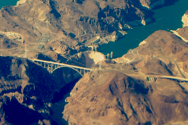
Three sources of water supplement Los Angeles since ground
water and surface flow where insufficient to meet the cities' thirst for water
as early as the 1880s. Coveting the Colorado River became a Southern California
habit after Hoover Dam was built in Boulder Canyon in the 1920s [below right].
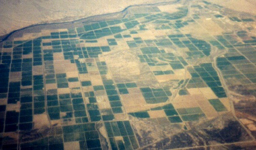
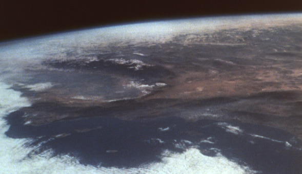
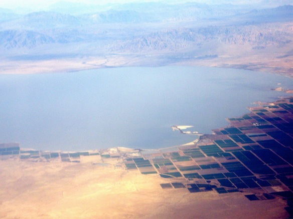
 The Colorado River may really belong to California–although its waters are shared with Arizona and three other western states. Photographed here [above left] the
river has carved a steep canyon south of Boulder Canyon and provides water to the Imperial Valley's irrigated
farmlands in the Sonoran desert.
The Colorado River may really belong to California–although its waters are shared with Arizona and three other western states. Photographed here [above left] the
river has carved a steep canyon south of Boulder Canyon and provides water to the Imperial Valley's irrigated
farmlands in the Sonoran desert.
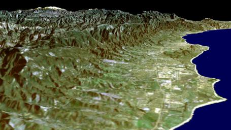
The Santa Barbara Channel
looking west to east, from Point Conception to Ventura a south facing stretch of coast akin to the Riviera and the salt marshes of San Francisco Bay.
The Great Valley, Salton Sea, Lake Tahoe, and
the Imperial Valley, gifts of nature to the pacific coasts' largest state.
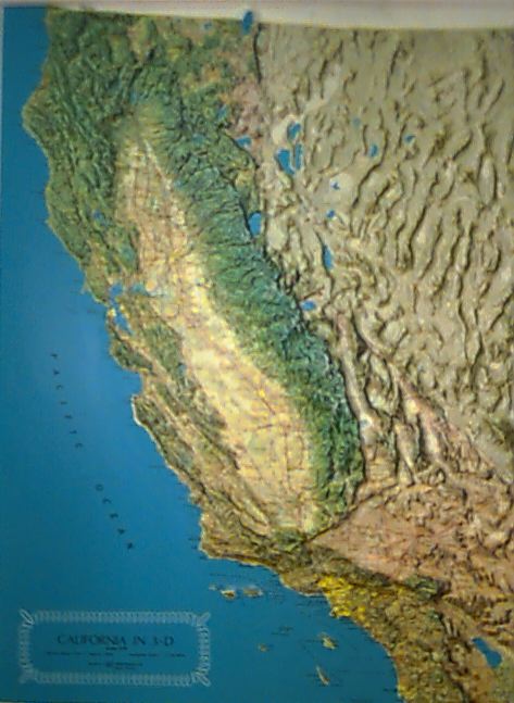
The relief map of the state of California and the Salton Sea in the Imperial Valley created by the runaway flood waters of the Colorado River, between 1905 & 1907.
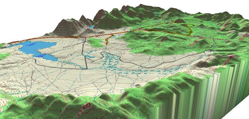 The Long Valley caldera in eastern California is the site of
one of the largest volcanic eruptions in prehistoric North America. The eastern Sierra and the deep valleys adjacent to the "range of light" remain
today a seismically active margin of the continent, underlain by hot spots of
magma and fractures called faults.
The Long Valley caldera in eastern California is the site of
one of the largest volcanic eruptions in prehistoric North America. The eastern Sierra and the deep valleys adjacent to the "range of light" remain
today a seismically active margin of the continent, underlain by hot spots of
magma and fractures called faults.
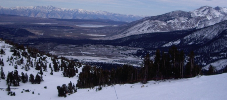 A view of the Long Valley caldera looking west to east across the caldera to the White Mountains east of Bishop, California.
Overview | Introduction | Maps | Photo Essay
of the landscape | The Great Thirst | Water
Seekers | Two Cities | Southern
Charm
-
-
-
-
-
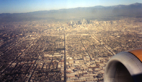
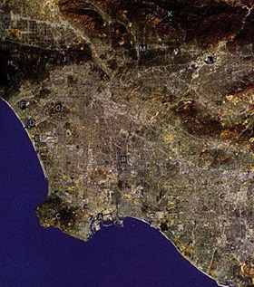
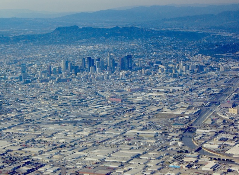
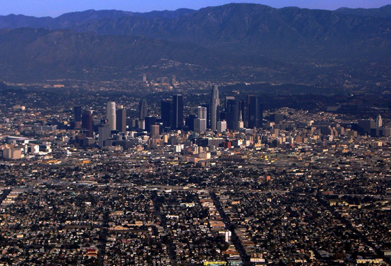
 Map
and views of Los Angeles
Map
and views of Los Angeles
-
-
-
-
- Preservation of monumental scenery
-
-
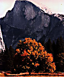 Half Dome, a mountain face in Yosemite
Valley, where Frederick Law Olmsted Sr. having seen the region in 1863, later recommended in 1865 that then President Lincoln
keep the area that had been set aside in 1864 for a public park because of its remarkable geology, trees, and wild amenities. Olmsted wrote a detailed report articulating the many reasons why a democratically elected government should set aside rare places of natural beauty for all citizens to visit, see and enjoy a healthy life.
Half Dome, a mountain face in Yosemite
Valley, where Frederick Law Olmsted Sr. having seen the region in 1863, later recommended in 1865 that then President Lincoln
keep the area that had been set aside in 1864 for a public park because of its remarkable geology, trees, and wild amenities. Olmsted wrote a detailed report articulating the many reasons why a democratically elected government should set aside rare places of natural beauty for all citizens to visit, see and enjoy a healthy life.
-
-
- In 1864, President Abraham Lincoln, granted the valley to the State of California (admitted to the Union in 1850) to be perpetually reserved as a park. It marks the earliest national attempt to create a public place from which the idea of national parks grew. The first National Park was Yellowstone, in 1872 created by Congress in the Wyoming territory.
Years later, John Muir suggested that the face of Half Dome, like the narrow, granite-walled, valley had been the product of glaciers advancing in the valley during the previous prehistoric ice ages. Muir and President Theodore Roosevelt camped together in the park in 1903.
-

Energy Market Reforms
-
Overview | Introduction | Maps | Photo Essay
of the landscape | The Great Thirst | Water
Seekers | Two Cities | Southern
Charm