Where | Cocos, Nazca & Caribbean Plates | Boundary plates | Mendocino Coast | on-line link
![]()
Plate tectonics is the name applied by experts to the facts and theories associated with the  movement of the crust of the earth. This movement is often called Continental drift, because of the slow movement of continental sized (and smaller) land-masses across the planetary surface of the Earth.
Plates are fractured pieces comprising the surface of the Earth.
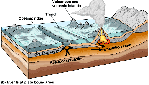
The planet's crust is made up of volcanic, sedimentary, metamorphic and organic rocks.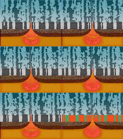 In this image the magma, or viscous material called lava rises from the mantle at a stylized mid-ocean ridge. The accumulating rock at either side of this rift builds up to push one side or plate of the Earth's surface away from the other side of the rift. Thus the two plates are moving apart or away from each other. The dark and light bands seen above refer to the age of the cooled magma, because as the magma cools its magnetic properties cause the alignment of particles in the cooling mass in relation to the earths magnetic poles. Periodically, as the magnetic poles of the Earth reverse, so the cooling magma's iron content aligns in opposite directions. This allows geologists to date the age of different ocean basins.
![]()
Where are the plates?
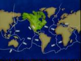
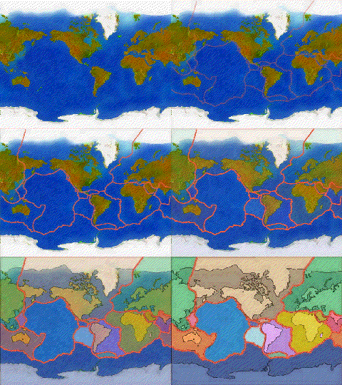
In this animation the different plates are delineated in relation to one another on the surface of the planet. It is as if the crust of the Earth is cracked into pieces like a ceramic dish plate dropped on a stone floor, except that the planetary fluid, or magma moves the broken pieces across the surface in three different ways.
Pieces of the planetary crust either collide in upheavals, or collide and one slips beneath the other piece, or they catch and grind past each other along fault lines. One such fault system is in southern and coastal California, called the San Andreas fault.
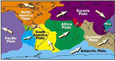
What are these plates doing? They are diverging, converging or slipping past one another. |
|
|---|---|
 |
 |
| Their direction of movement laterally | The direction of movement vertically |
This varied movement of the surface through a billion years explains to a large extent both far-flung rock formations with similar structural elements and the dispersal of animals and plants across the Earth's several continents. If you look closely at the smaller plates riding between Africa and Eurasia, or the Pacific, South American and North American plates, or the Pacific and Eurasian plates you detect several smaller but nonetheless active plates where zones of fracture or movement have caused earthquakes. Japan, the Caribbean Antilles and Arabian and Red Seas are just such places where smaller plates are sheared by the larger tectonic forces exhibited by more massive adjacent plate movements. These are areas of historical movement because of plate tectonics.
Animals and plants have adjusted over millions of years to these often subtle, but occasionally damaging movements that may also trigger volcanic activity, especially in the Pacific where one plate is moving beneath the neighboring plates. Thus, the existence of marsupials in Australia and New Zealand, or the speciation of birds in the Galapagos Islands that baffled Darwin and his associates, are well accounted for by the more recent understanding prevailing today that the stages of evolution for plants and animals are related to the configuration of plates and plate margins in the geological past. In other words, the surface of the earth – although it looks stable – is actually slowly moving at centimeters per year or inches per decade.
Plate margins may either diverge or converge.
In areas where these margins diverge rift valleys dominate, and where they converge are subduction areas. These subduction areas exist in the Pacific, Caribbean and Indonesian basins where oceanic island arcs form.
Caribbean Plate | Cocos Plate creating Isthmus of Panama | The Himalayan massif.
Mid-Oceanic ridges move plates apart
Where | Cocos, Nazca & Caribbean Plates | Boundary plates
The continents are merely the weathered surface of accumulated igneous, metamorphic and sedimentary rocks that have been pushed up by the movement of the Earth's fractured, and ceaselessly moving surface.
Where | Cocos, Nazca & Caribbean Plates | Boundary plates
![]()
Plate Boundaries account for earthquakes an accreting terrains that attach to continents because of the movement of one plate underneath another bordering plate.
For more on orogeny and a series of ancestral mountain building slides go here –– http://plate-tectonic.narod.ru/orogenamphotoalbum.html.
![]()
Summary | What | Cocos, Nazca & Caribbean Plates | Boundary plates
![]()
Earth's surface is actually a shifting sort of mixture of rocks called a thin crust.
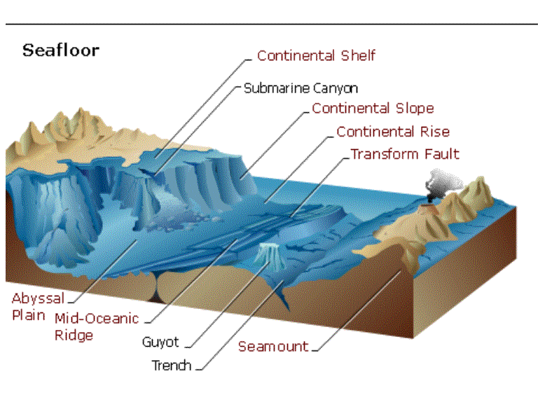
The crust, by analogy, is like an outer skin that forms on cooling porridge or thick pea soup. Both the planet's rotation on its axis and the rising currents of hot magma ascending up from the mantle of the molten core move these blocks of terrain we call the land.
Any landscape, seascape or underwater features are actually a composite of the underlying forces brought to bear on the surface rocks once the movement o of the plates or the shearing of the plates has exposed rocks to the weathering of the surface due to erosion by water, wind, ice or radiation.
As the plates move climatic conditions changed and different forms of life were selected for by changing geological conditions.
The Devonian Period gave rise to fish whose lineages remain extant today.
The carboniferous forests are the source of much of our coal.
Where | Cocos, Nazca & Caribbean Plates | Boundary plates
![]()
![]()