
I. Describe your interest in seaside places.
II. Then compare its features and elements with two partners and identify common themes.
What is your restoration interest in seashores and island places?
I. Describe your interest in seaside places.
II. Then compare its features and elements with two partners and identify common themes.
Relate these places that you like to concepts raised by: Bates, Siry, Sarfina, Emerson, or Lewis Thomas, and McHarg, pp. 7-30, especially Oystering – about Artists, what are they like and what defines the character of these places?
![]()
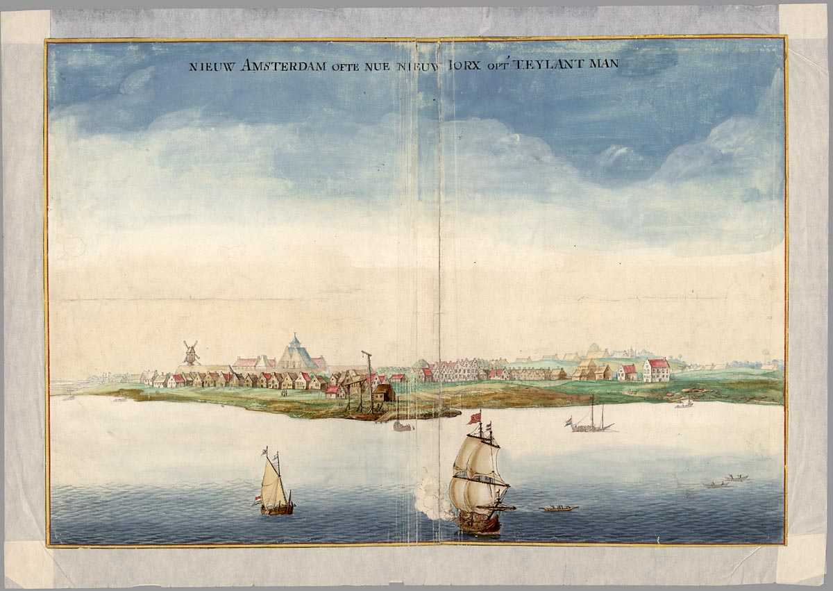
Manhattan south end of the island, 1630.
![]()
Elements are land, air, and water; but strictly speaking refer to carbon dioxide, nitrogen, oxygen, sodium-chloride, and phosphorus.
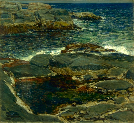
Features are clouds, sunset, forested as opposed to exposed slopes, lakes, mountains, bare rocks.
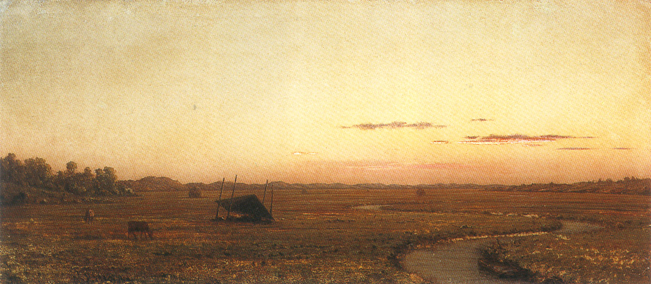
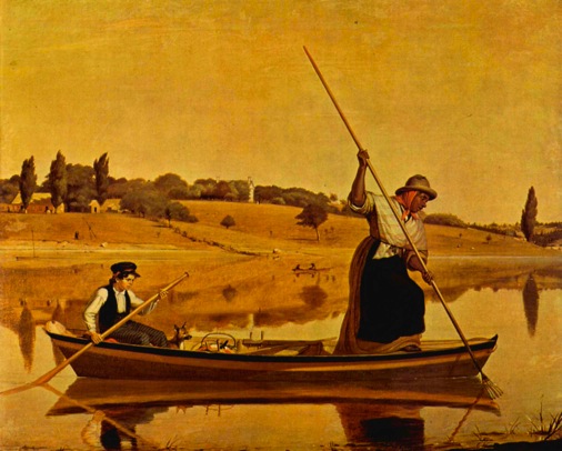
Martin Johnson Heade's paintings of the Newburyport, Massachusetts' salt marshes.
What do you make of the clouds as a gathering storm and of the absence of people on the left as opposed to bright sky on the right?
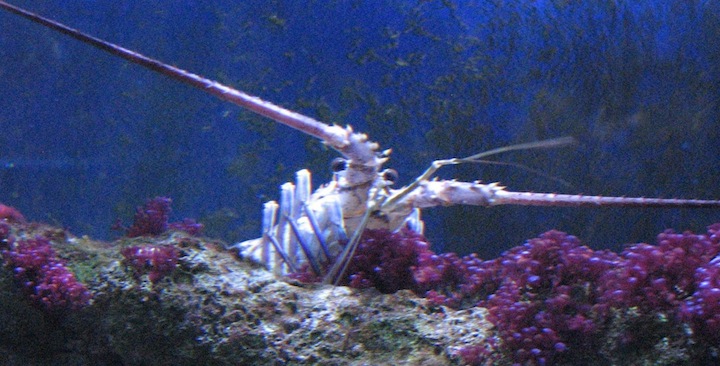
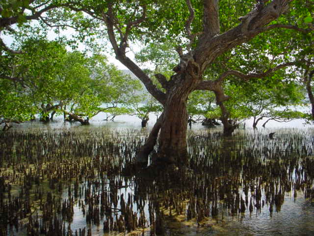
Rock lobster, Panulirus argus, and littorina angulifera, the Mangrove periwinkle; a salt water snail – sometimes called periwinkles feed on marine algae. Both of these very different creatures depend on Mangrove forests for all or part of their life cycles. Together the forests of the sea and these animals depend upon one another and the conditions that promote healthy shoreline forests.
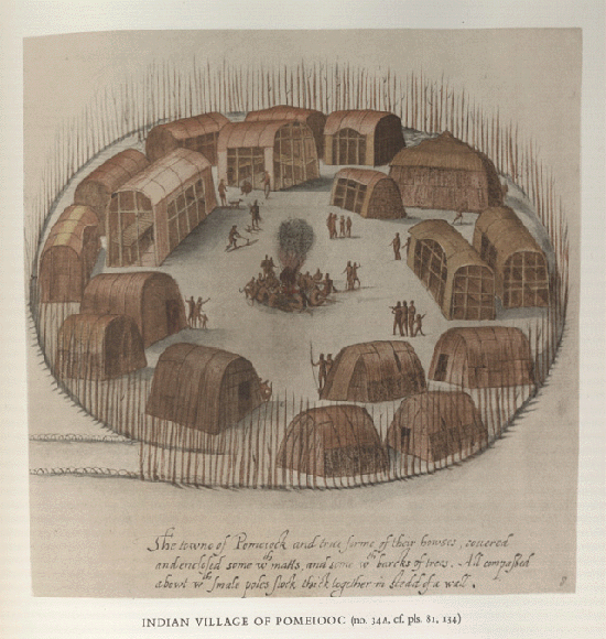
Native American Village in Virginia
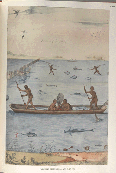
The Ancestral Amerindian people moved up and down the seaside of the Atlantic offshore islands.
John White's water colors of a Chesapeake Bay indigenous village.
Maps | Wetland Restoration Projects | New York | Mangroves | Artists | Amerindian fishing | Indigenous coastal villages | Eel fishing | Aquifer recharge areas | Salt marshes
The eel fishing along Long Island Sound in the northeast:
Aquifer recharge areas of sand hills on Long Island, New York.
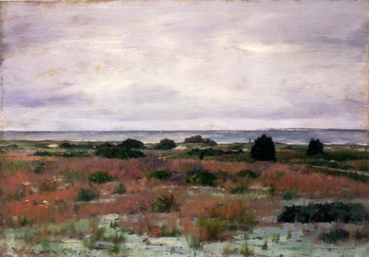
A view from Shinnecock Hills above the sea on Long Island New York, painted by William Merritt Chase, in 1895.
Maps | Wetland Restoration Projects | New York | Mangroves | Artists | Amerindian fishing | Indigenous coastal villages | Eel fishing | Aquifer recharge areas | Salt marshes
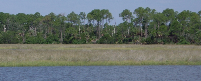
Wacasassa River, northern Florida.
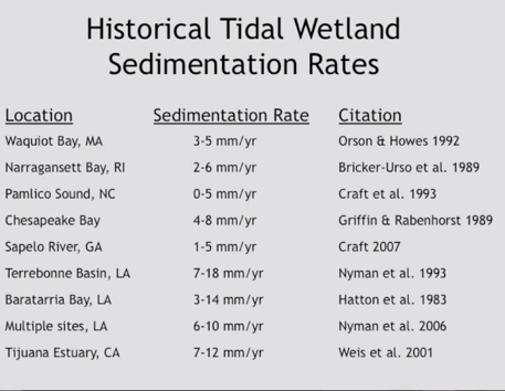
Rates at which silt is building up (accreting or accumulating) in different tidal marsh and mud flat terrains.
The importance of tidal wetland restoration given abrupt climate change driving an increasing rate of sea-level rise. Anticipated wetland losses in the coming century.
San Francisco Bay restoration projects. Once upon a time we had 196,000 acres of tidal wetlands ringing San Francisco Bay. The Bay formed when ice caps melted and the seas rose 10,000 years ago, flooding river valleys as far inland as present-day Napa. Those were the days when the baylands were much more than a patch of pickleweed or a meadow of cordgrass: Creeks and rain emptied the soils and runoff of whole watersheds onto the marsh plain.
The restoration of Hamilton Airfield to tidal marsh habitat, California.
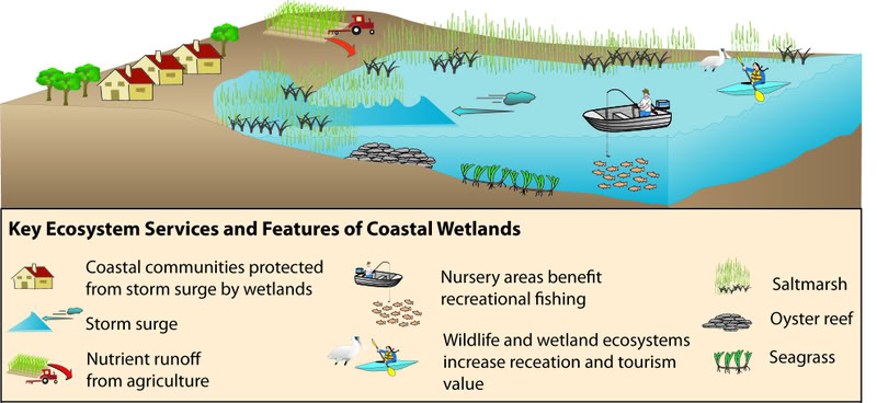
The existing types of coastal wetlands. "Over 50 percent of commercial fish and shellfish species in the Southeastern United States rely on coastal wetlands," is a reason for example to protect vulnerable marshes and tidal flats. See also – http://www.americaswetlandresources.com/background_facts/detailedstory/types_wetlands.html.
Restoring tidal flats in Ago Bay, Japan from previous rice paddy cultivation by The Department of Agriculture, Fisheries, Commerce and Industry of Mie Prefecture. http://www.japanfs.org/en/news/archives/news_id030434.html
"Study reveals threat to tidal wetlands"
by David Malmquist | November 6, 2009
"A new study co-authored by VIMS professor Carl Hershner shows that more than half the tidal wetlands along the U.S. East Coast—habitats that sustain commercial and recreational fisheries, filter pollutants, and protect against storms—will disappear by 2100 if current shoreline-protection strategies continue to block their landward migration in the face of rising sea level."
"The authors suggest an alternative regulatory framework that encourages a combination of "living shoreline" techniques to preserve wetlands, and requirements to make up for lost opportunities for wetland migration by facilitating such opportunities elsewhere."
"The maps show that 42% of land lower than 3 feet along the US Atlantic coast is already developed and thus likely to be protected as sea level continues to rise. Land-use planners expect that another 15% of the area will be developed in the coming decades. Thus almost 60% of low-lying coastal lands are likely to be developed and eventually protected as sea level rises."
http://www.vims.edu/newsandevents/topstories/archives/2009/wetland_threat.php
Rolling easements to deal with an ever shrinking tidal shoreline.
Science Daily, 2013.
Direct human impacts, not rising seas or rising CO2, have the most power to alter those thresholds, the scientists report. Groundwater withdrawal and artificial drainage can cause the land to sink, as is happening right now in Chesapeake Bay. Because of this kind of subsidence, 8 of the world's 20 largest coastal cities are experiencing relative sea-level rise greater than climate change projections.
In addition to building vertically, marshes can also respond to sea-level rise by migrating landward. But, the authors note, human activities have hindered this response as well. Conventional ways of protecting coastal property, such dykes and seawalls, keep wetlands from moving inland and create a "shoreline squeeze," Kirwan says. Because rates of marsh-edge erosion increase with rates of sea-level rise, the authors warn that the impacts of coastal barriers will accelerate with climate change.
Source– Matthew L. Kirwan, J. Patrick Megonigal. Tidal wetland stability in the face of human impacts and sea-level rise. Nature, 2013; 504 (7478): 53 DOI:10.1038/nature12856
Video on wetlands & sea level rise: "From the Coastal Conservation in the Face of Rising Seas session of the CNPS 2015 Conservation Conference, "Tidal wetlands and sea-level rise", by John Callaway of the University of San Francisco."[Feb 10, 2015] – "extremely vulnerable to sea level rise." https://www.youtube.com/watch?v=r5nks9Tbmag
Maps | Wetland Restoration Projects | New York | Mangroves | Artists | Amerindian fishing | Indigenous coastal villages | Eel fishing | Aquifer recharge areas | Salt marshes
Some species that indicate the ecological integrity of places:
Panulirus argus (Latreille, 1804), rock lobster.
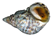
The Littorina angulifera, is the mangrove periwinkle, a common intertidal snail in mangrove forests of the southeast United States.
Gopherus polyphemus, the Gopher tortoise.
Ostrea virginica, intetidal oyster is an indicator species of estuarine water quality and a keystone species.
The three steps: One | Two | Three
Maps | Wetland Restoration Projects | New York | Mangroves | Artists | Amerindian fishing | Indigenous coastal villages | Eel fishing | Aquifer recharge areas | Salt marshes