 Landscapes of order in U.S.A.
Navigating the site:
United State's Land System
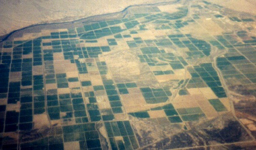
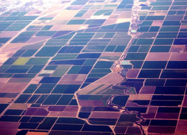
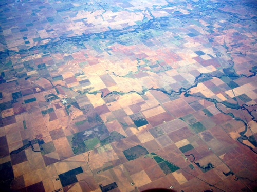
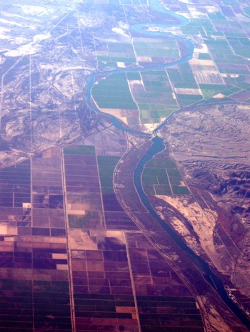
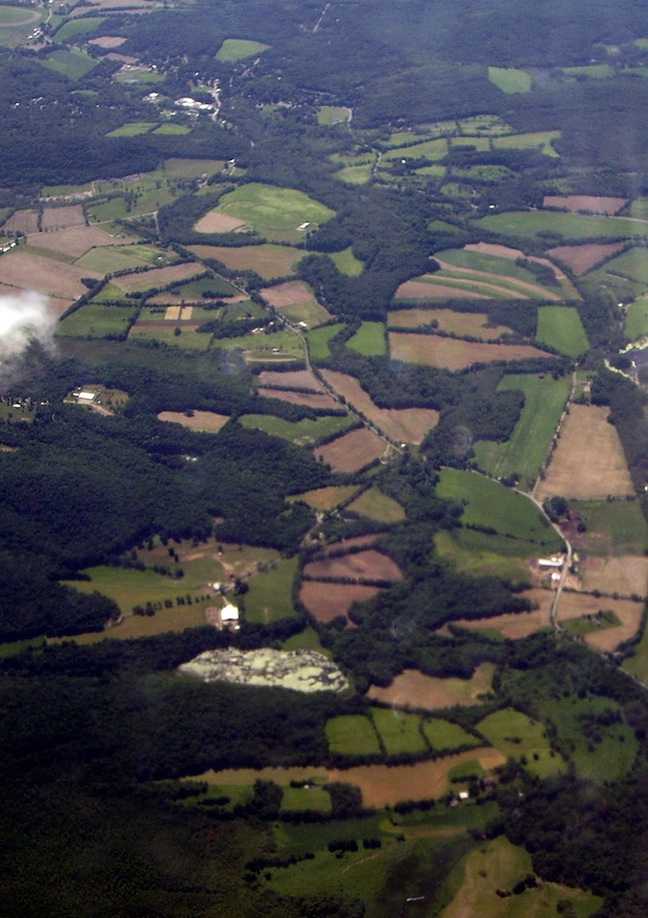
Colorado River Valley at the California and Arizona state boundaries.
The river moves along the upper right across the top of the picture down to the left.
Pattern | Origins | Township and Range system | Maps | Land measures | Township square displayed | Compare land-use
The grid pattern is the dominant layout of the landscape in spite of the intervening river.
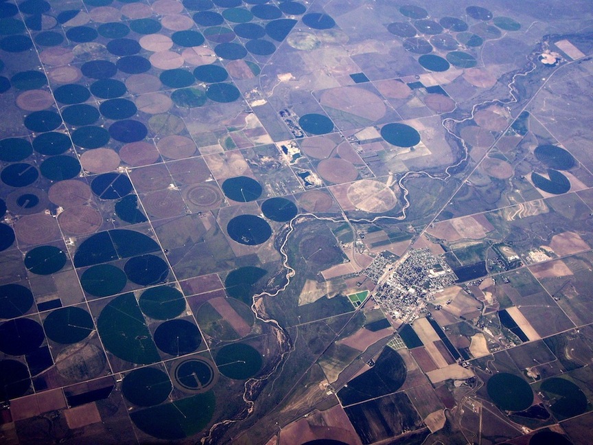
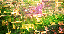
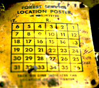
Checkerboard pattern
Pattern | Origins | Township and Range system | Maps | Land measures | Township square displayed | Compare land-use
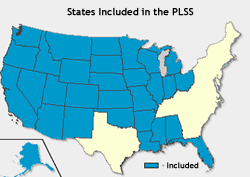
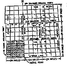
1787, The Articles of Confederation Congress passed a Land Ordinance based on a rational means of surveying land in the western territories – shown in blue on the map below – to facilitate the disposal of allegedly unclaimed lands in the public domain. The land was to be cleared of Native American title before the United State Land Office would hold a public auction to dispose of the lands that had been surveyed.
This survey system became common through all states west of the Appalachian mountains and is called the "township and range" system. Because of the checker board pattern the appearance of this system on the land is called a grid.

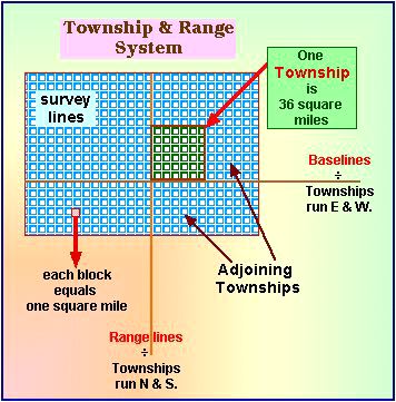
- baselines are parallel to latitude lines
- range lines are parallel to longitude lines
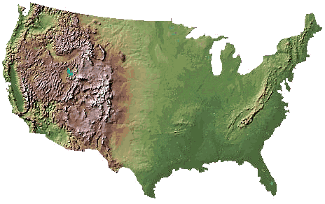
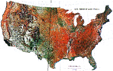
The lower USA extends from latitude from 25 to 50 degrees North & longitude from 65 to 125 degrees West.
Identify the black vertical band that forms an imaginary line from top to bottom of this above image, near the middle of Texas. The line running from north to south, that is drawn on this map above is the 100th Meridian. To the west of that meridian the amount of annual rainfall is insufficient to sustain farming on the high plains without irrigation.

Pattern | Origins | Township and Range system | Maps | Land measures | Township square displayed | Compare land-use
- A regular division of land into townships
- Ease of locating land sales.
- The plan was to favor settlements.
- The plan was designed to sell public land at auction.
- The proceeds went into the treasury to pay government debt.
Land measures
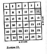
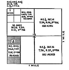
Each large block is thirty - six sections.
Each small block equals a section and 1 section is a square mile 640 acres in a section
half sections equals 320 acres
quarter section equals 160 acres
Uniformity across the public domain
The township
A square mile delineated with thirty-six sections.
Pattern | Origins | Township and Range system | Maps | Land measures | Township square displayed | Compare land-use
| Contrasts |
US high plains
|
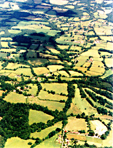
Southern Britain
|
|---|---|---|
| land pattern | 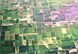 |
|
| Western U.S. surveyed parcels. | Medieval land-use from rogation patterns. | |
|
|
|
| Colonial |
Chesapeake
Bay |
Eastern
Europe |
| West | East | |
|
|
|
| Grid | Colorado River Valley |
Dutch settlement patterns in Hudson Valley |
The Township and Range system of the post-revolutionary American landscape contrasts with colonial land grants.
Compare with J.B. Jackson's Sense | Compare with Terry Tempest Williams | Compare with Marshes of the Ocean Shore
Gerald Durrell | D. H. Lawrence | Arnold Pacey | Tim Radford | Norris Hundley | Mary Austin | John Wesley Powell | Wallace Stegner
Loading
Pattern | Origins | Township and Range system | Maps | Land measures | Township square displayed | Compare land-use