E
N 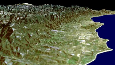 S
S
W
Coastal Geography, geology and geomorphology, California & the Caribbean
California the
long shore current moves from south to north even though the offshore
deeper California Current moves from north to south. Similarly the Gulf
Stream moving deeply along the Atlantic from south to north setting up
a long shore current dragging water from north to south actually brings the warm tropical water of the Caribbean to the cold, often frigid waters of the British Isles and the North Sea thousands of miles to the northwestern coasts of Europe.
Water along the shore -- because it moves three ways in relation to the land-- moderates the climate, generates winds and brings rain, or moisture to the landscape in all but the fiercest of deserts.
Land is best understood as the product of the geological and geographical factors at work on earth.
• geo, means earth from Gaia, Greek for chthonic deity of the earth.
• geology allows us to understand the shape, movement, and underlying forces that affect the current vegetative, animal and human communities along the shore.
Here there is evidence of one plate going under another -- the foreground emerging to form a plateau in the background.
Terms
riparian, or stream side: Latin meaning literally beside rivers
edaphic conditions, edaphic climax means stunted trees instead of larger tree stands because the soil nutrients, water, and "hardpan" deposits make an impermeable surface that the roots of the trees cannot penetrate.
Estuaries are unseen treasuries.
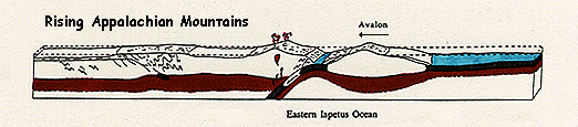
Orogeny refers to the process of mountain building.
plate, a piece of the earth's surface made of either basalt or lighter rocks that adhere sufficiently together to move across the crust as heated magma from below causes these blocks to move.
subduction, to sink beneath or go under. As seen here the Island arc called Avalon ( a terrain) is subducted under, or sinks beneath the North American plate where plate boundaries meet and thereby causing the Appalachian Mountains to rise up.
 \
\
water movement:
Three ways in relation to the land are
- in centrifugal gyres around the edges of the ocean generating currents (Coriolis effect) and countercurrents (water moving in the completely opposite direction, along the equator).
- up and down as in the movement of the tides, or in up welling along the coast.
- in and out as in a river (up and down river) mouth or inlet where the current reverses itself due to the flood or ebb of tides.

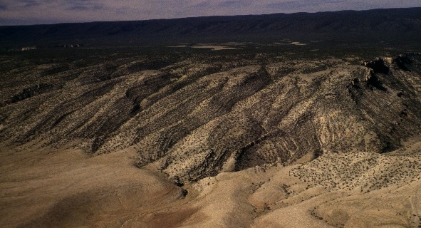
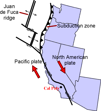
Geological forces within the earth are sheering this section of the Pacific Plate off as it slides along a transform fault moving northward with respect to the rest of the state of California.
Pacific Coast, the unstable edge of the San Andreas coast.
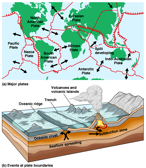
Plate boundaries:
| static view of fracture zones |
dynamic movement |
|
 |
|
|
Plate tectonics (more).

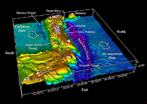
Caribbean and Atlantic plates are shifting past each other.
Geology
The study of the earth's historical record of rock formation from the deposition due to weathering of land forms and erosion in the distant past. The planet's surface is really just a very thin shell of solid basalt (oceanic basin rock) or lighter terrestrial igneous or sedimentary rocks of silica and limestone. The magma from the molten hot interior rises to the outer crust where currents drive the fractured parcels that make up the surface shell.
Tectonics is the focus in geology that interprets the movement of the crust as it shapes the terrains on the earth's surface.
The surface of the planet is fractured into dozens of separate land masses called "plates." Plates can move over, under and passed one another as the pressure of the magma underneath the crust builds on the plates above, because heat cause the magma (lava) to rise and move along the surface under, between or on top of the crust.
In areas where the plates move past one another, there is a series of surface fractures in each adjacent plate which we call faults. The San Andreas fault is the most studies system outside of Japan because the cities of Los Angeles and San Francisco lie along the boundary of the two plates. In 1906 the city of San Francisco was destroyed by an earthquake associated with slippage of these plates passed one another.
California geology for over 90 million years.
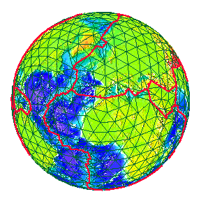
California's current plate boundaries.
Pacific Ocean
 The Great Basin
Mexico
The relation of these plates is such that the outer oceanic section or Pacific Plate is moving slowly to the north north west and sinking under the ocean, while the North Atlantic Plate is moving to the south-southeast and rising up over the ocean plates.
Cape Mendocino represents a transition from the transverse plate movement to a subduction zone where the part of the Pacific plate -- a subsection called the Juan de Fuca plate-- is slipping beneath the North American continent.
That movement of the Juan de Fuca plate beneath the continent is what has cause the volcanic arc of mountains called the northern and southern cascade ranges that stretch from northern California to British Columbia in Canada.
"For tens of millions of years, a lithospheric plate of considerable size lay between North America and the Pacific Plate. It is known in geology as the Farallon Plate. By the late Pliocene, this great segment of crust and mantle, possibly at one tine a tenth of the shell of the earth, had in large part been consumed."
John McPhee, Assembling California, p. 182.
Mendocino County
"One of the most interesting geological areas in the northern hemisphere."
Teresa Sholars, State Park brochure, 1998.
"Now, in the Holocene, the triple junction is still moving north. For the moment, it is at Cape Mendocino, where the San Andreas (Fault) ends and what is left of the Farallon Trench continues."
McPhee, op .cit., p. 183.
"Along this portion of the Mendocino Coast the land has been uplifted into a series of flat terraces," five terraces in all one higher than the level below.
"Each terrace is approximately 100,000 years older than the lower terrace."
The five terraces that comprise the "Ecological Staircase" are remnants from the sea floor that reveal the movement of the crust over the last half million [500,000] years.
But, weathering and leaching of nutrients is a key reason for the stunted trees that grow ever smaller at each elevation as you climb up the side of the coastal mountain range.
Vegetation adjusts to geology, climate, soils, water, and animal intrusions.
Marine terraces:
Soil composition alters what thrives in any area, but especially in wet coastal terrains.
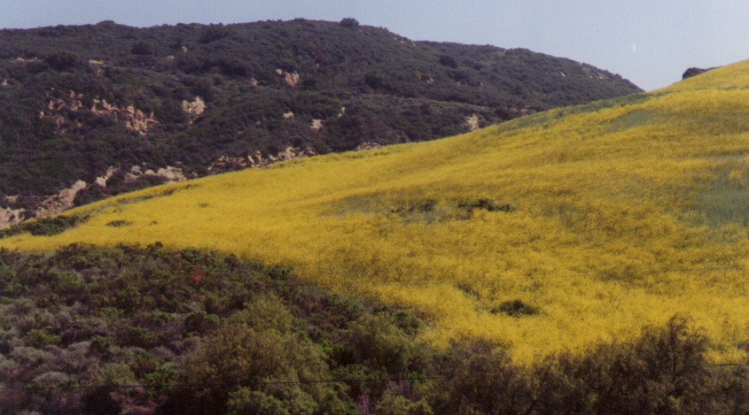
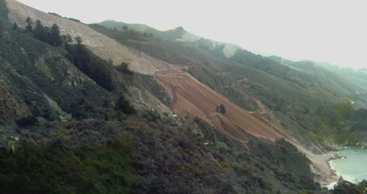
Chaparral and coastal grassland, Santa Barbara County. JS, 1999
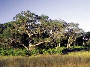
maritime forest:
Estuaries are unseen treasuries.
California's Great Central Valley
The Central Valley 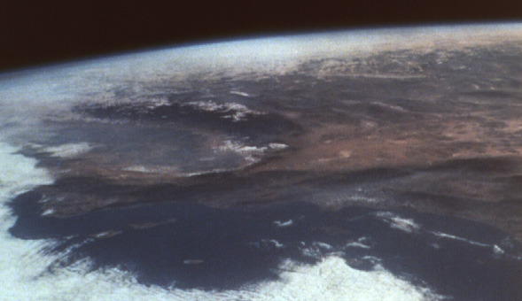 San Andreas Fault system
The great valley of California as seen from from space, was believed to have been formed by a tectonic plate from the Pacific Ocean floor that slid into the Sierra Nevada island arc of mountains millions of years ago.
Final
By a formal final essay, I mean a seven page, typed (12 point double spaced),
paper with either footnotes or endnotes, a list of sources --including your explicit references to all of the books--, and a time line
and abstract (makes up the 8th page).
The essay's abstract or summary is presented (not read) in a rehearsed five
minute verbal presentation at the final exam period, including every author's
opinions on how to protect coastal natural areas and the wildlife that depend on these reserves.
essay sample
Real versus ideal