
" . . . we have a glimpse of ourselves and of our world islanded in its stream of stars."
|
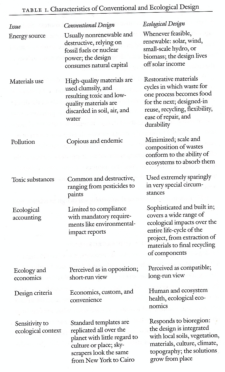
Island's composite features |
" . . . we have a glimpse of ourselves and of our world islanded in its stream of stars." |
|
Physical | Biological | Social
Map | Zones | Restraints | Sources | Index to planning an island | Course index | Books | Concepts | Water
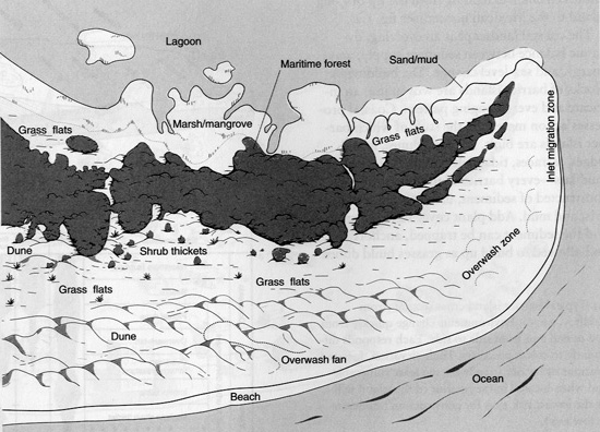
Island overview: parts of a barrier island are divided into zones.
Island Profile
Map | restraints | Sources | Index to planning an island | Course index | Books | Concepts
![]()
Enchanted Isle maps and project.
Map | restraints | Sources | Index to planning an island | Course index | Books | Concepts
![]()
on land use by percent of acreage needed for natural functions.
No place, even heavily urban areas can --nor should they-- be fully developed. Many urban locations have large areas of barren land, left vacant from poorly designed developments in the past.
Restraints
Restraints persist in any geographical area due to geological (soil), geomorphological (shape), topographical (surface contours), hydrological (moving water) and vegetational conditions (forests, grasslands, deserts) or the combined ecological constraints operating across boundaries.
Even heavily developed islands, such as Manhattan or peninsulas, such as San Francisco possess natural areas (open spaces) characterized by native and introduced vegetation. Central Park, the Brooklyn Botanical Gardens, or the Bronx Botanical Gardens in New York, or Golden Gate Park in San Francisco are examples of refuges for natural features, surface water and native vegetation to flourish beyond the pavement, structures and buildings of any urban setting. Urban spaces can of course be enhanced by natural and cultural additions to the features of any place.
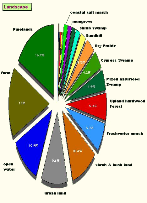
| landscape features | acres | percent |
|
3,629,440 |
5,671
miles |
|
173,984 |
8.09% |
|
339,706 |
15.8
% |
|
181,792 |
8.3
% |
|
118,896 |
6.0
% |
|
248,816 |
11.7% |
|
356,688 |
24
% |
|
1,419,882 |
73.89% |
The extent of land use categories with respect to the urbanization of Philadelphia from the 1950s to the present.
Adapted from Ian McHarg's Design with Nature.
Map | restraints | Vegetation | Sources | Index to planning an island | Course index | Books | Concepts
![]()
Physical | Biological | Social
The habitat approach to seashores
Physical
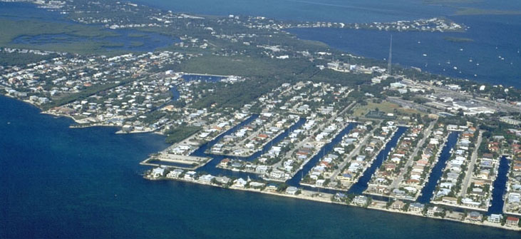
Barrier Islands migrate
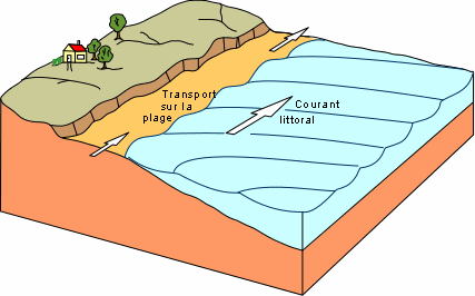
Barrier Islands, created by longshore currents, are associated with the ocean margins of estuaries.
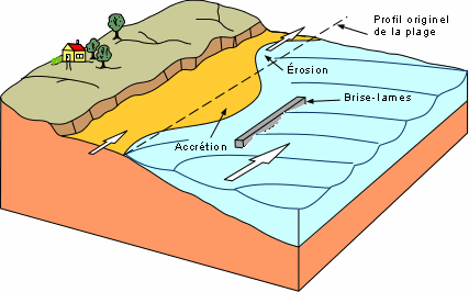
Water movement and density of water masses in an estuary affect biological conditions because the mixing of water tends to trap essential nutrients.
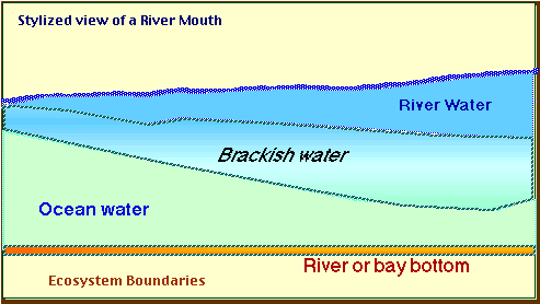 |
||
|---|---|---|
<==== Down stream |
Estuarine area |
Up stream ====> |
Biological
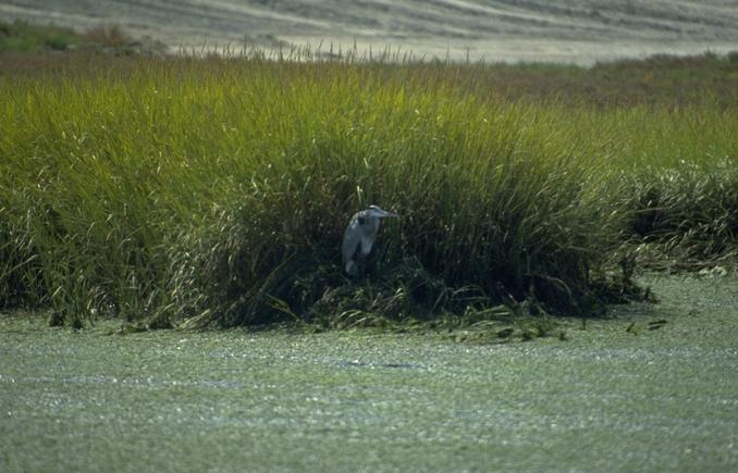
| Beach | Piping Plover |
 |
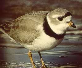 |
The Fish and Wildlife Service writes that "Piping plovers return to their breeding grounds in late March or early April. Following establishment of nesting territories and courtship rituals, the pair forms a depression in the sand somewhere on the high beach close to the dunes. The nest is sometimes lined with small stones or fragments of shell."
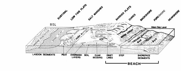
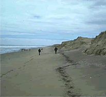
Beach Profile
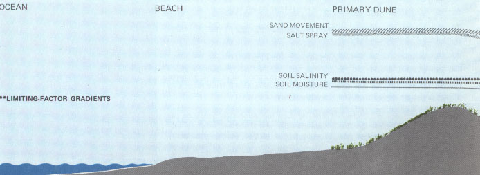
............................. Salt water | sub tidal | Fore shore | beach berm | Back shore | transition | ..... Fore dune.............. | ..... Dune crest..... | ........Back dune
The zones are separate areas referred to as zonation within the Beach, shoreline areas. These beaches are called habitats by ecologists and naturalists to distinguish one area of the shoreline from another section.
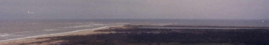
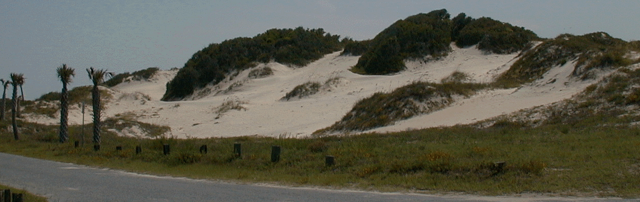
Cape Hatteras, North Carolina.
Map | restraints | Vegetation | Sources | Index to planning an island | Course index | Books | Concepts
![]()
![]()
 |
 |
|---|---|
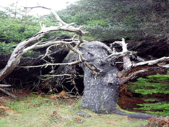
| Krummholz effect: wind and salt from the ocean shape the tree. | Types of vegetation associations found in Florida |
Forests edge Shrubs edge Grasses edge Forbs–pioneers edge
![]()
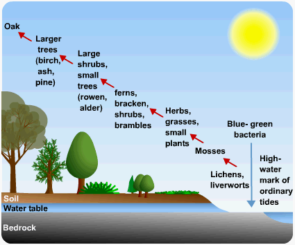
The tendency over time for diversity to increase if conditions are left relatively undisturbed. |
|||
|---|---|---|---|
Stages |
common plants |
# |
duration |
pioneer species: |
railroad vine, ipomea, | 1 |  seasons seasons |
Forbs, |
dandelions, phlox, artemisia, rocket, a non-woody plant that is not a grass. | 2 | 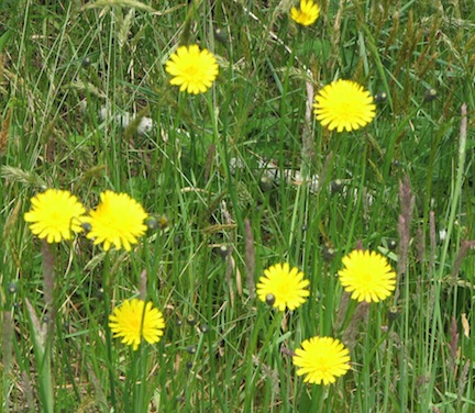 two-years two-years |
Grasses |
marram, sea oats, salt grass, spartina | 3 | 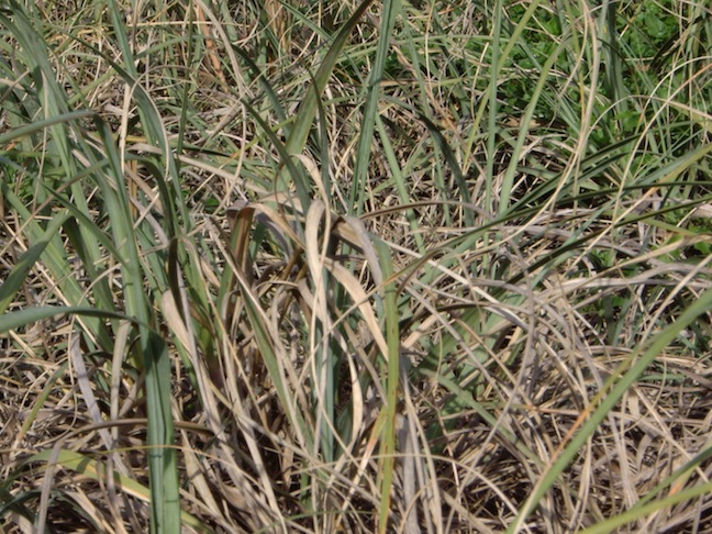 more years more years |
Shrubs |
coyote bush, ilex, berries, willows, alders, ceonothus | 4 |  a decade a decade |
Forests |
pines: loblolly, pond, sand, longleaf, limber | 5 | 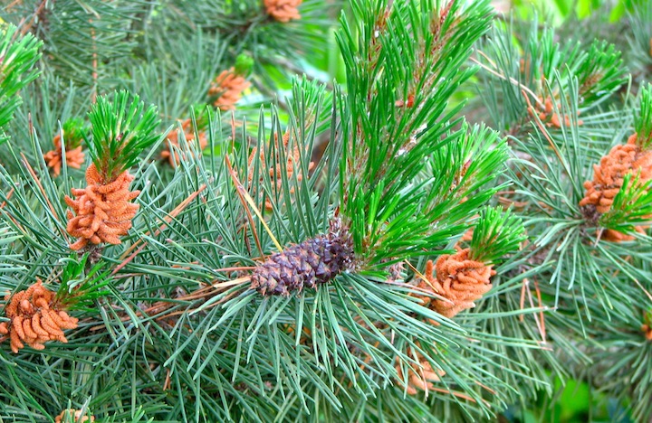 fifteen - twenty years fifteen - twenty years |
| Secondary | oak, hickory, maple, birch, aspen, | 6 | 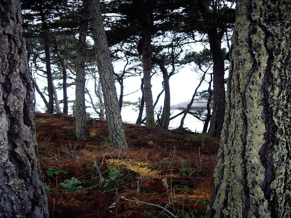 fifty - sixty years fifty - sixty years |
"Old growth" |
cypress, cedar, redwoods, taxus, | 7 | 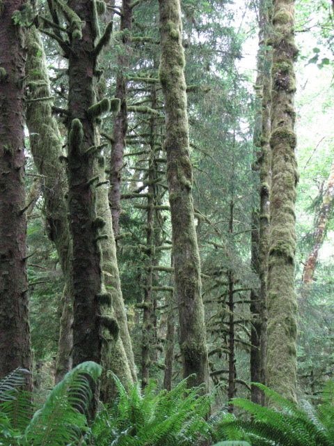 century + century + |
Map | restraints | Vegetation | Sources | Index to planning an island | Course index | Books | Concepts
![]()
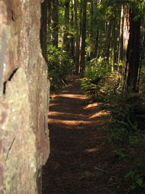
Maritime Forest
Map | restraints | Vegetation | Sources | Index to planning an island | Course index | Books | Concepts
![]()
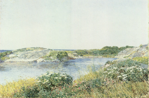
Lagoon
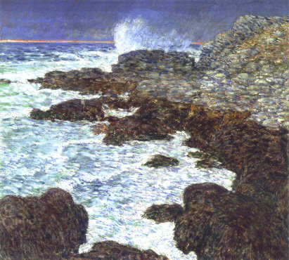
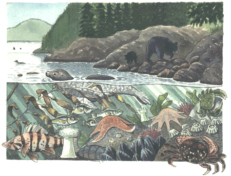
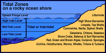
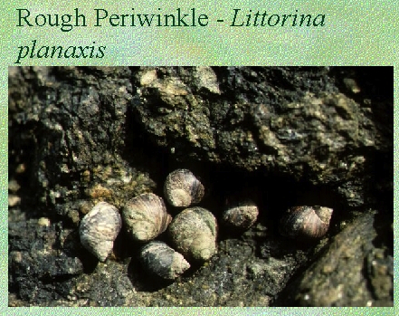
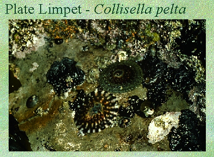
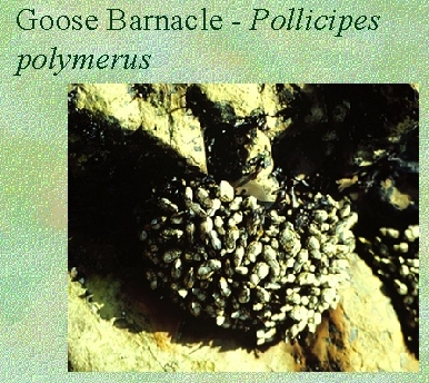
The Rocky Shore:
"When the tide is rising the shore is a place of unrest."
Carson, Edge, p. 39.
Zonation
 |
 |
|---|---|
organisms of the rocky shore |
Tidal variation along the shore |
Snails, starfish, anemones and barnacles are just some of the organisms well suited to make the rock shorelines quite productive.
 |
 |
 |
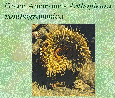 |
Types of rocky shore organisms.
Map | restraints | Vegetation | Sources | Index to planning an island | Course index | Books | Concepts
![]()
Salt marshes are dominated by Spartina alterniflora and Spartina patens or cord grasses that withstand periodic submergence by marine water.
![]()
![]()
Map | restraints | Vegetation | Sources | Index to planning an island | Course index | Books | Concepts
![]()
![]()
Henry Beston, The Outermost House.
International Council for Local Environmental Initiatives: ICLEI 
Affordable homes Alexander built in Mexicali, rural California
http://www.geniusloci.com/eco.html
Real Goods, Hopland, California
