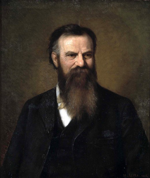
"The importance of Powell' s report lay in his adaptation of land and water laws, technology, and institutions to the dry-drought prone West. He influenced subsequent reclamation policies, provided for comprehensive land surveys and land-use planning."
". . . professed a political faith in communal water ownership.
A realistic appraisal of the varied lands in need of comprehensive regional planning."
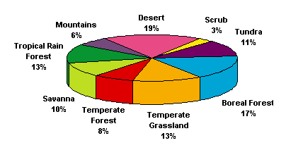
 Lesson One: The Biomes of North America
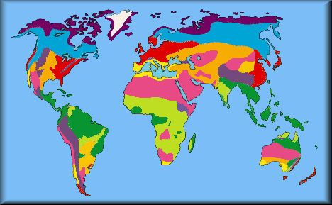
 John Wesley Powell and C. Hart Merriam understood the conditions that shifted plant associations and in North America meant the east was significantly different from the west.
Today we call these associations of vegetation biomes and they are characterized by common climate, cycles of rainfall and evaporation, soil qualities, altitude, latitude, prevailing winds and associated animal grazers and predators such that moving from one geographical region to another a recognizable change is apparent from the humidity, to the temperature, and the annual snow, fog, or rainfall patterns among many other factors.
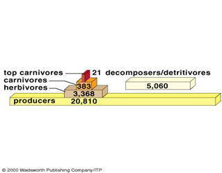
Grassland biome's productive parts:
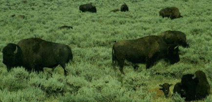
Herds of bison are the herbivores of grazers that thrive in this arid range-land
Biomes differ by the amount of life, measured in biomass sustained by the conditions.
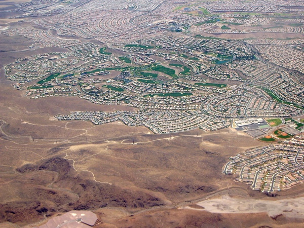
Las Vegas, the quintessential New Jerusalem.
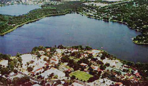
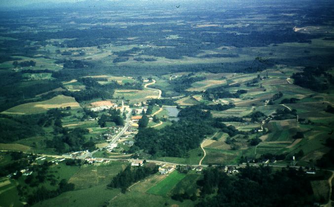
Rollins College is situated on Karsts terrain or a limestone topography, in the St. Johns River valley, with a sub-tropical climate with distinct wet and dry seasons (winter is usually dry, while summer is the rainy season).
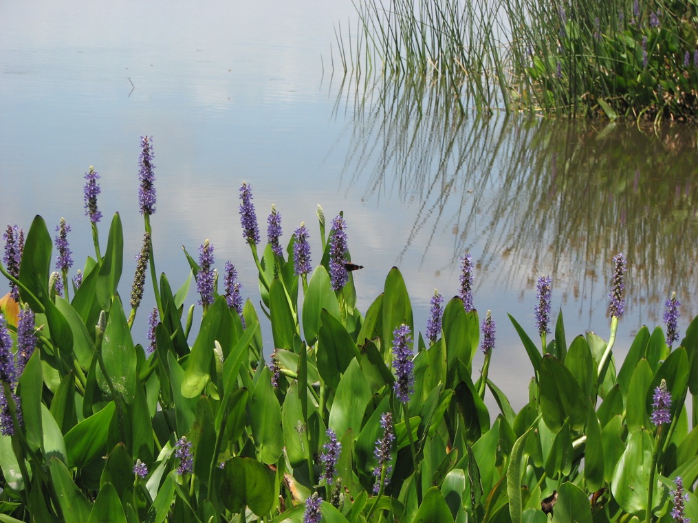
Pickerel weed marks the water's edge as an emergent aquatic plant in a pontederia marsh
Water borders are actually indicators of growing plant communities season after season in Florida that has a distinct dry and wet season alternation over the course of a year, thus affecting the growing seasons of fruits, vegetables and exotic plants, just as much as frost affects the length of the growing season to the north.
![]()
For you to learn:
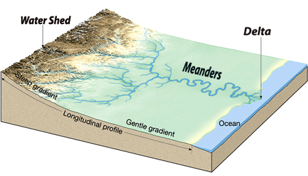
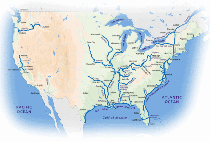
In what watershed and the bio regional provinces of North America have you lived for the longest time?
The assignments are to assist you to write an essay on what is worth protecting in the nation based on the names of key people, like Marsh and Powell and significant ideas concerning ecological areas of the nation's geographical features:
Where are these places?
1. Eastern Seaboard ...the tidewater, fall-line & piedmont plateau.2. Southern Coastal Plain ...Sea Islands, Florida, Mississippi Delta & Cuba.
3. Appalachian Highlands ...Alleghenies, Smoky Mountains, Cumberland Gap, the Shenandoah and Monongehelia Rivers.
4. Central Region ...Prairies, Ohio & Missouri River Valleys, Great Plains.
5. Pacific Rim ...Sierra Nevada, Cascade and Rocky Mountains, the Great Basin, Columbia & Colorado Rivers, Yellowstone Basin & Yosemite Valley.
A Polish landscape depicting the human imprint on the European environment.
[Global Ecology]
[Schematic models] [Links] [Course
overview]
[My Rollins Home Page]
![]()
These buttons below work as navigational aids.
![]()