Land System of the US
Townships
A designation in the United States for land after the custom of New England Colonies dating from the 17th and 18th centuries.
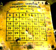
At the left is a Forest Service identification and location marker that has a rendering of the land system of the USA "public domain" on the metal plate. It designates that this parcel in the Sequoia National Forest is in section 33. The "T" and the "R" stand for the Township and Range as determined by federal surveys.
This system goes to the very founding of the Republic before the Constitution was approved, when the nation was governed by the Articles of Confederation in 1785.
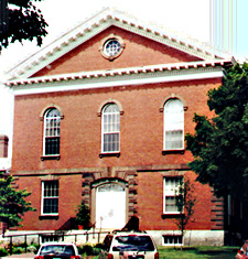
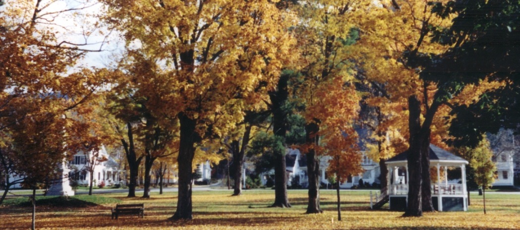
Concord township's Meeting House and Vermont Town common were expressions of civic unity.
"The New England Town was the American version of the English Parish and the farm village with its arable strips and common lands recalled the late medieval patterns of East Anglia, but there were significant differences ..."
p. 104, D. W. Meinig (1886).
In this photograph of Old Sturbridge Village' s fields, forest
and pasture on may get some hint 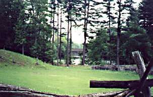 of the rural countryside from
which American attitudes in the United States towards land, and of the rural countryside from
which American attitudes in the United States towards land, and as a consequence
natural resources, emerged prior to the Civil War. This place in the Connecticut
River Valley was at once the frontier of the 17th century settlement and the
edge of the 20th century imagination. The village is designed to convey to visitors
what life was like before the industrial revolution transformed work, residences
and ways of relating to each other.
of the rural countryside from
which American attitudes in the United States towards land, and of the rural countryside from
which American attitudes in the United States towards land, and as a consequence
natural resources, emerged prior to the Civil War. This place in the Connecticut
River Valley was at once the frontier of the 17th century settlement and the
edge of the 20th century imagination. The village is designed to convey to visitors
what life was like before the industrial revolution transformed work, residences
and ways of relating to each other.
In Jacksonian America the farm was the seat of most people's experience of life in the nation. As many people then lived on farms as a percentage of the population as live in cities or suburbs today. The nation was comprised of agrarian hamlets, towns and villages, not unlike this painting of the Connecticut countryside and the colonial recreations.
Small scale buildings, encircled by fields, adjacent to forests and fed by streams, springs and wells, Americans cherished their individual liberties. Chief among these rights was the ability to own the land in what was then called "fee-simple absolute." Owning land was a possibility for a few middle class families whose relatives served in the armies to fight foreigners and Indians, or who had the capacity to settle beyond the surveyed lands of the national government. These lands that belonged to the federal government were called the public domain and they are part of a uniquely American concept. The roots of this Jacksonian agrarian perspective, lay in Thomas Jefferson's influence and ideas.
Life in the New England hinterlands, to a great extent, influenced national patterns of settlement, land tenure, legal obligations, governance and citizenship until the nineteenth century. Thomas Jefferson looked to the ideals of the New England towns as a means of establishing the power of small land holders in the new republic. To that end he influenced, educational institutions, manumission and the land ordinance of 1785.
"The Land Ordinance of 1785, defining a system of surveys and sales of congressional lands, was the first attempt to bring some order to the frenzied scramble among a welter of avaricious interests, large and small, local, national and international, to reap some profit out of this vast national domain."
p. 342, D. W. Meinig, The Shaping of America: A Geographical Perspective on 500 Years of History, Volume 1, ( New Haven: Yale University Press, 1986).
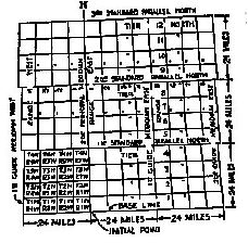
How were Townships surveyed?
 |
  |
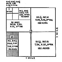
|
Acres in one section |
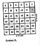
The relation of one section to others
in the area |
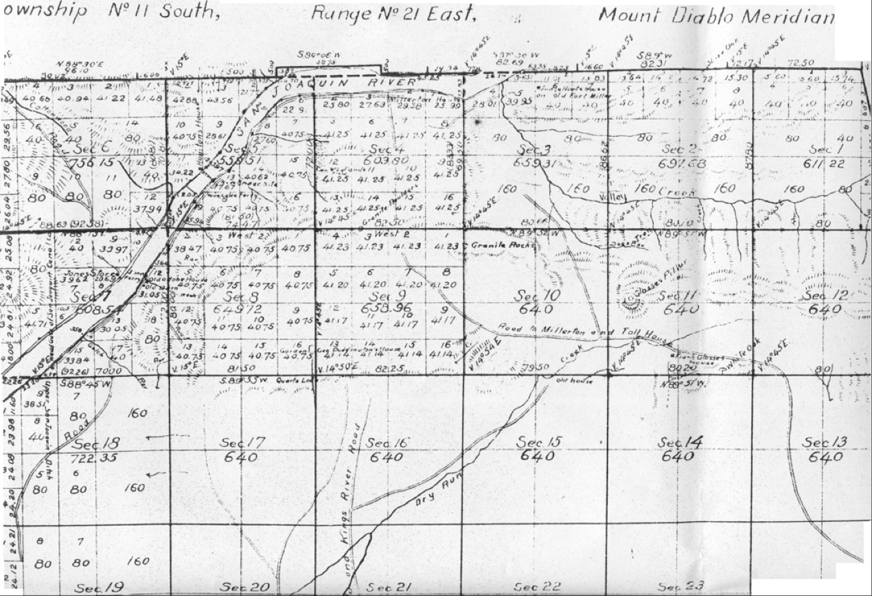
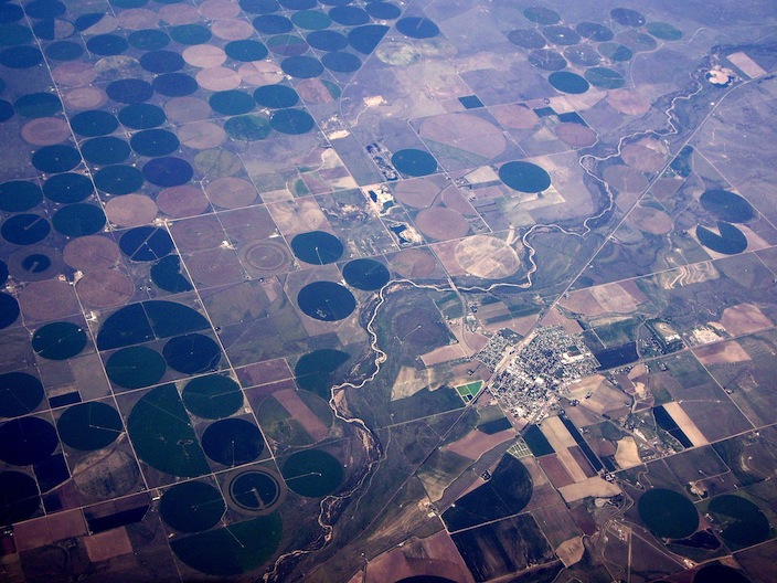
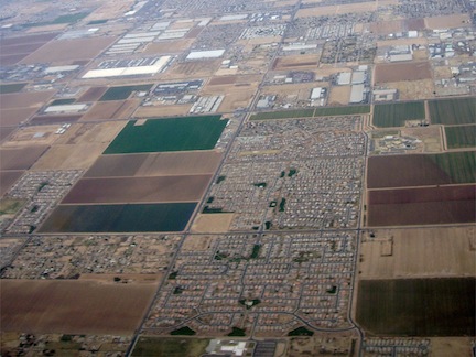
These drawings demonstrate the Jeffersonian faith in rationality and orderliness in settlement that led to the widespread adoption of a survey system known in North America as the "township and range system"
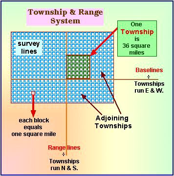
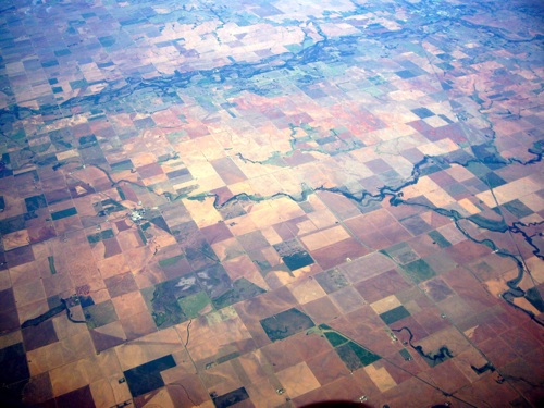
One township is 36 square miles or thirty six sections.
One section is equal to a square mile.
One square mile is equal to 640 acres:
or one section = 640 acres
a half section = 320 acres
a quarter section = 180 acres
Game of the Estates | Township description example
Last Updated on March 13, 2013. February 1, 2012, from 1/15/2005.
By Joseph Siry
schedule | Courses | Atlas | site-map | Ecology | laws | quick look Science Index | Site Analysis | Population Index | Global Warming Index | Nature Index | Genes
Terms | Glossary | Word webs | Basic vocabulary | Advanced Vocabulary | Antonyms | Synonyms
Writing | Interviews | Free Writing