Any map is an approximation of the whole, a viewpoint or perspective, and thus it becomes a geographical model.
See a more detailed Map
of the US
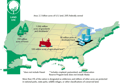
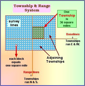
Historical land use patterns in the US have been influenced by this land system.
|
Since
the Land Ordinance of 1785,
areas of the nation
seized from Native peoples and newly acquired lands from England,
France, Spain, Canada, or Mexico were surveyed using the above
grid pattern. Originally recommended by Thomas Jefferson as a
rational means of surveying newly acquired territories, the Township and Range system can be found on deeds today. In those parts
of the country, such as Florida, Texas or California and Oregon where these regular rectangles are not
used the land had been surveyed and granted by the sovereigns
of the Empires or countries from which the new territories were
acquired. |
Directions | HABs, hazardous algal blooms | migrations | Hurricane Coast | The Americas in 1797 | land use | two regions | U.S.
Directions | Coastal population 2000 | migrations | Hurricane Coast | The Americas in 1797 | land use | two regions | U.S.
historic depopulation of the interior 1990s
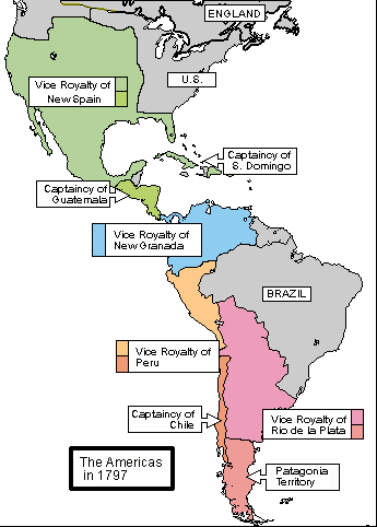
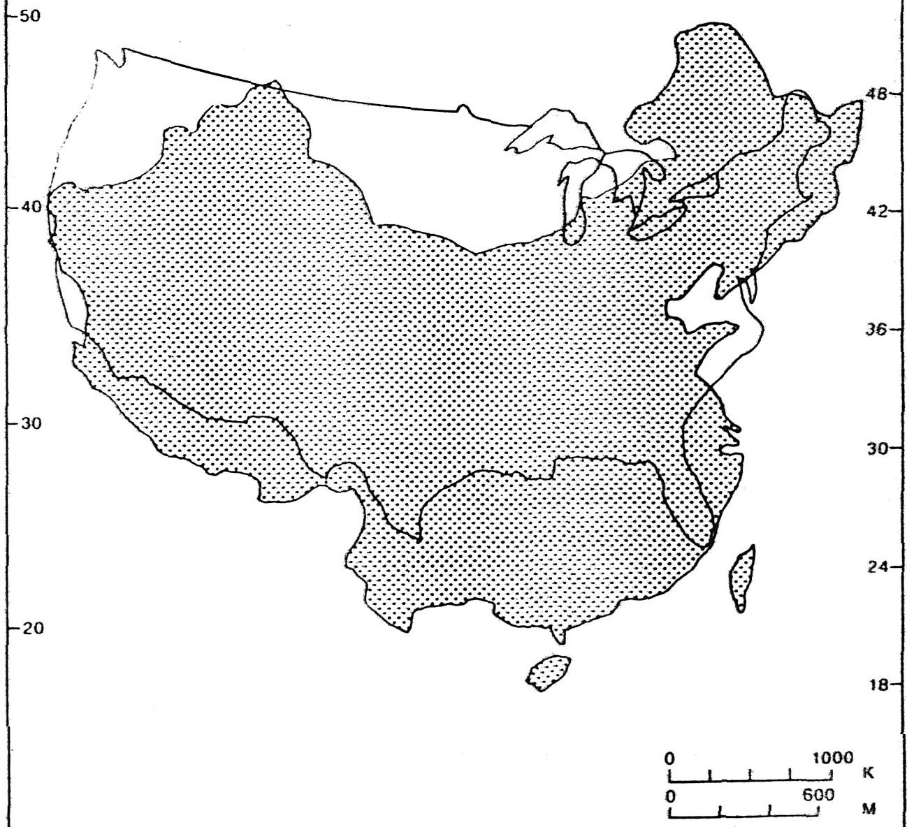
The America's after the French Revolution's historic impact.
Directions | HABs, hazardous algal blooms | migrations | Hurricane Coast | The Americas in 1797 | land use | two regions | U.S.
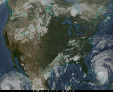
Storms come in many shapes but two tropical cyclones are shown below on this satellite image and they help us to define the hurricane prone regions of the Caribbean and Pacific regions North America.
Directions | HABs, hazardous algal blooms | migrations | Hurricane Coast | The Americas in 1797 | land use | two regions | U.S.
The line dawn vertically on the map below is the 100th meridian, that is a line 100 degrees west of the Prime Meridian that bisects London through the district of Greenwich, hence the name the Greenwich meridian. The one hundredth meridian divides the most eastern areas of the US from the arid regions of the Great Plains, Rocky Mountains, and the far western frontier to the Pacific Coast.
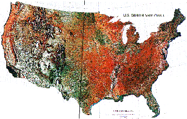
Arid western regions | humid (more rainfall) east.
Directions | HABs, hazardous algal blooms | migrations | Hurricane Coast | The Americas in 1797 | land use | two regions | U.S.
North
West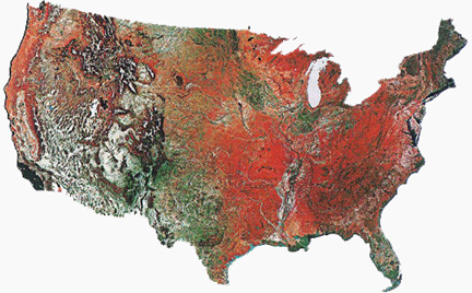 East
East
South
Directions | HABs, hazardous algal blooms | migrations | Hurricane Coast | The Americas in 1797 | land use | two regions | U.S.

American landscape art | Landscape index | Sense of Place | American artists
[Global Ecology]
[Site] [Schematic
formulas] [How we learn] [Nature
Links]
Course descriptions :
History, Caribbean,
Science
Home Page for research
pictures
Last Updated on September 11, 2008