Location as related to site analysis: milieu, sun angle, water, climate, and transport.
Analytical Planning | Land System | Milieu | Water | Value Inventory | Site and Sun | Air | Wildlife | Goal
|
Great
Britain looking north northeast from the English Channel |
British
countryside; southeastern England. |

the totality of the situation due to weathering, climate, topography and hydrological influences on vegetation, wildlife, people and dwellings.
The oikumene was the Greek concept of the collective improvements on the land made by communities engaged in agriculture, mining, transportation or other commercial activities. Humans were visualized as creating a second nature within the original, unfinished and crude conditions of creation. Hence the notion of refinement, the process by which raw materials are transformed, made more usable, and distributed among dwellers.
Analytical Planning | Land System | Milieu | Water | Value Inventory | Site and Sun | Air | Transport | Goal
Solar radiation, sun declination, insolation and thermal gain or loss
Sun and radiation exposure varies seasonally and recurs annually depending on latitude.
Analytical Planning | Land System | Milieu | Water | Value Inventory | Site and Sunlight | Air | Transport | Goal

The main shopping street, Stockbridge, Mass., The Berkshire Mountains.
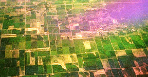
US Land system called Township and Range, established in 1785 created a pattern on the land, below the city of Denver, seen here in winter accentuates the rectangular pattern of the United States land survey system.
 |
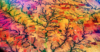 |
| Grid pattern on the land in western Kansas. | The grid pattern in the Township & Range system ends amidst the rivers of the high plains. |
Analytical Planning | Land System | Milieu | Water | Value Inventory | Site, Sun and Sunlight | Air | Transport | Goal
Milieu, is defined as the totality of the situation of any setting due in part to weathering, climate, topography and hydrological influences on vegetation, wildlife, people and dwellings.
Township in South Africa near Capetown.
Analytical Planning | Land System | Milieu | Water | Value Inventory | Site and Sun | Air | Transport | Goal
Water, forms a waterscape by its movement or flow onto, into and off from any terrain. Rainfall that seeps into the groundwater nourishes the water table whereas the runoff travels across the surface and collects in ponds, pools, lakes or streams. These features either allow water to sink into the ground or gather together into rivers that make their way unto the lowlands and into the seas.
Rivers are only the most apparent features on the land carved by the force of running water.
The Little Colorado River in the Grand Canyon.
Climate, weather & air currents and atmospheric pressure create the rainfall and temperature patterns that characterize any terrain.
The Earth's atmosphere, is a thin protective layer of vaporous gas composed mostly (4/5ths) of nitrogen and (1/5th) oxygen. Oxygen in the form of stratospheric ozone blocks dangerous UV radiation from reaching the surface vegetation and animals.
"Above all, the Earth's atmosphere was changed in the intervening time because
of the accumulation of molecular oxygen generated by water-splitting bacterial
and plant photosynthesis. In turn, the oxidizing atmosphere made it possible
to shield the biosphere against UV radiation with stratospheric O3 (ozone) and
to produce such abundant compounds as the metallic oxides and biochemically
important soluble nitrates and sulfates needed for biomass production."
Vaclav Smil, p. 229.
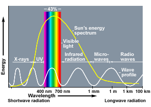
solar radiation fuels the earth.
 |
 |
 |
|---|
The visible spectrum is just a sliver of the solar radiation striking the planet, but red & blue frequencies of radiation trigger photosynthesis in bacteria & plants.
![]()
Energy available from solar radiation to any sight is an important determinant of conditions needed to sustain life, although without water life will not endure.
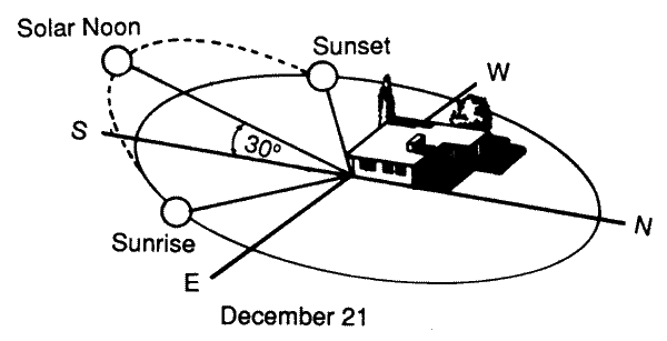 The primary values of a setting are defined geophysically
by the exposure to the sun throughout the year.
The amount of solar radiation determines evaporation rates for water, transpiration in plants, the amount of soil moisture, the abundance and types of vegetation found in places.
The winter solstice is the shortest day of the year the northern hemisphere.
Sample designs: http://www.ecodesign.org/edi/projects-d.html
Territory is from terra, the in word for earth:
describe the terrain, topographical features, slope and geographical aspects of the setting. Landscape is from the Dutch word for the transformation of landscape by humans and their animals.
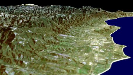
Transportation elements are the single most influential aspects of land use plans.
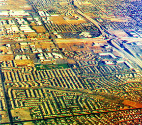
Phoenix, in winter, accentuates both the grid and patterns of modern highways that dominate surface transportation networks.
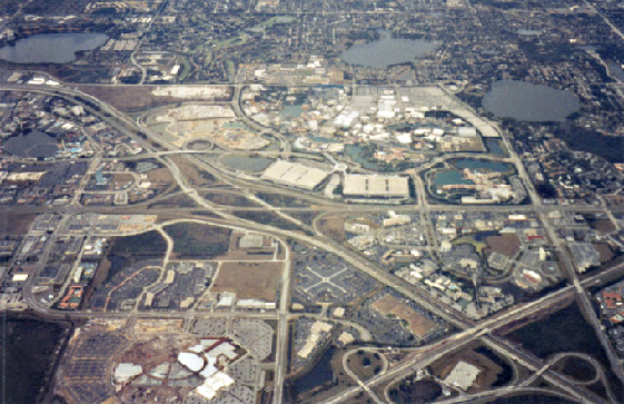
Highways and parking lots physically intrude on space, generate heat contributing to urban heat islands, deflect, concentrate and contaminate water adding to runoff into lakes and rivers with added sediment and nutrients.
Imagine using parking lots for more than just the above damaging practices?
Vegetation characteristic of the area and the region is a definitive quality of any site:
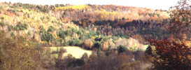
Green Mountains in Vermont,
Global warming will over time cause the retreat of the sugar maples (Acer, sp.) north into Canada.
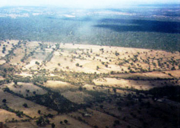
|
|
| Layout of the famous Gardens of Versailles constructed by Louis XIV, King of France. |
Wildlife that frequents a sight may often do so to either maintain or expand its range, feeding or nesting grounds.
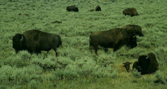
American bison or buffalo, once roamed from Central Florida and Pennsylvania to the Rocky Mountains.
![]()
Analytical
Planning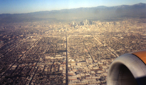
Values Inventory for Ecological Planning Method:
Slope, surface drainage, soil drainage, bedrock foundation, soil foundation, erosive capacity, land values, tidal inundation,
historic values, scenic values, recreational values, water values, forest values, wildlife values, residential values, institutional values.
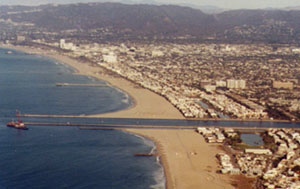
The Los Angeles Basin looking north from the south central basin.
places | A sense of place | what places are | sense of place index
| Identifiable function | description of the features | Points |
| Slope | ||
| surface drainage | ||
| soil drainage | ||
| bedrock foundation | ||
| soil foundation | ||
| erosive capacity | ||
| land values | ||
| tidal inundation | ||
| historic values | ||
| scenic values | ||
| recreational values | ||
| water values | ||
| forest values | ||
| wildlife values | ||
| residential values | ||
| institutional values | ||
|
Highest
ranking features & Total |
Scale of values assigned to feature:
High = 4 | Medium high = 3 | Medium low = 2 | Low = 1 | no identifiable value = 0
|
|
absence of significance |
|
unknown | 0 |
| some significance |
|
Low | 1 | |
| conflicting significance |
|
Medium low | 2 | |
| multiple significance |
|
Medium high | 3 | |
| complementary significance |
|
High | 4 | |
Planning Method | Antonyms | Landscape Values | McHarg Methodology | McHarg Notes | Islands | planning Index
Last Updated on 7/15/2008, from 12/15/04.
By Joseph Siry
schedule | Research | Atlas | site-map | Ecology | laws | quick look
Science Index | Site Analysis | Population Index
Seashore | Global Warming Index | Nature Index | Research sites | Genes
Writing | Interviews | Free Writing