
Navigating the site:
The History of the Dividing Line, William Byrd
![]()

![]()
Physical geography of the coastal seaboard's rivers, tidelands and swamps. ![]()
Biogeography, the natural history (naturalists) of the mineral, plants and animals. ![]()
Economic geography, the political concern for taxation and Indian-white relations. ![]()
![]()
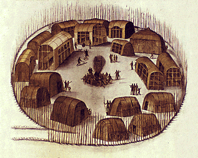
Indian commodities, they brought over some of that bewitching vegetable, tobacco.
Pages, 1-2.
Also potatoes, corn, beans and squash.
He describes the hurricane, air, rain storms, soil quality, where and how rivers meet, all these are physical characteristics of the places the survey team is measuring.
The "dirty" land, water logged soils, obstructions in the form of dense reeds, trees, bogs, mosquitoes and steep river banks inland among the pine forests, orchards and fields.
Making borders requires an enormous exertion of labor, materials, and time and the process ends up with a map.
Among many natural features he mentions cedar, cypress, and pine trees, medicinal shrubs, the wax myrtle used for wax candles, rattle snake root to heal snake bite, and birds such as wild turkeys, buzzards and huge flocks of passenger pigeons.
The survey team begins its work after traveling south from Norfolk, that he describes as among the best situated settlements in all of the area, into what is now Northern Currituck County, North Carolina.
![]()
HISTORY
OF
THE DIVIDING LINE:
RUN IN THE YEAR 1728.
1.
William Byrd's description of a survey line
to settle a disputed boundary between the older colony of Virginia and the
newer colony of Carolina bears many parallels the "Frontier of
estuaries," chapter in that unsettled land is often described as
"dirty," or "impassable," emphasizing "though we picked our way, up to the knees in
mud." (p.15)
2.
Byrd, who accompanied the survey team –people
carrying 60-70 pounds of equipment and provisions (p. 19.),–often describes coastal Virginia as so damp to the point of causing diseases, or as
the residence of peculiarly behaving people who "devour so much swine's flesh, that it fills
them full of gross humours." (page 17)
3.
Siry uses such examples of disease and obstructing
swamps from other parts of the country's tidewater terrains to explain one of
the incentives for drainage and reclamation of coastal land. While Byrd argues at some length about why the Dismal swamp should be drained and reclaimed.
4.
The boundary line that Byrd is surveying is for the
purpose of creating better maps to
settle revenue disputes among the mother country and the sister colonies, but
in so doing he describe Norfolk town plantations, woods, particular native and introduced
species, and crops of both the settlers and the indigenous Algonquin peoples
(esp. pp. 35-37).
1585-1593, John White's map of the territory William Byrd, in 1705, some 145 years later describes: is in the British Museum to see the map go there.

|
Technology index ![]() landscape index
landscape index ![]() words index
words index ![]() map index
map index ![]() photograph index
photograph index
![]()
• Striped Bass spawning -- "Striped Bass migration routes from the principal spawning grounds of the Chesapeake Bay, Delaware River, and Hudson River" into the Gulf of Maine and return.
![]() HISTORY OF THE DIVIDING LINE: RUN IN THE YEAR 1728.
HISTORY OF THE DIVIDING LINE: RUN IN THE YEAR 1728.